You are here: Home > Network List > TA - USArray Transportable Network (new EarthScope stations) Stations List
> Station G59A Clarenceville, QC, USA > Earthquake Result Viewer
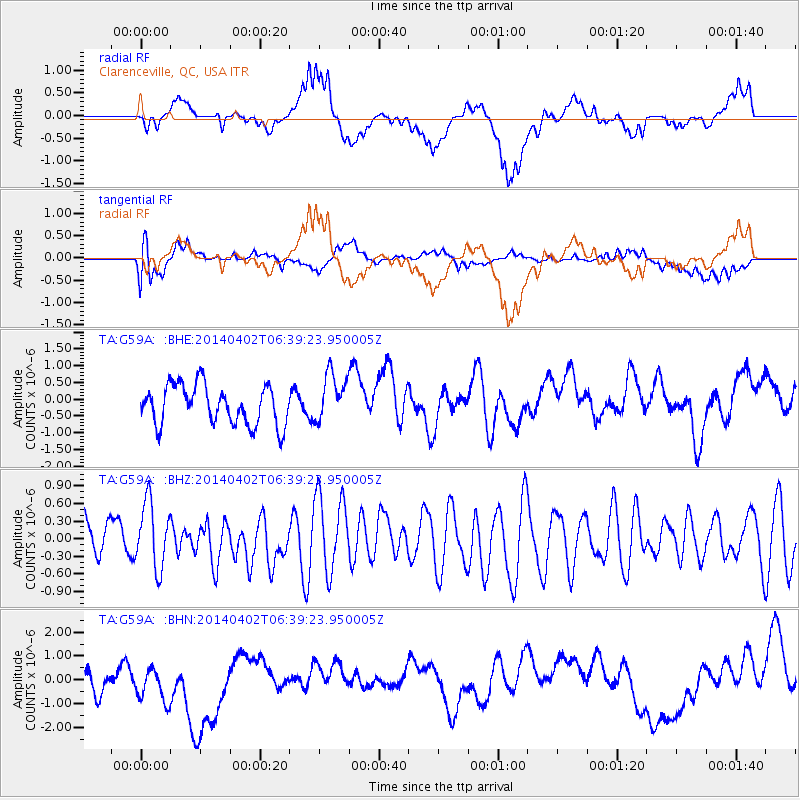
G59A Clarenceville, QC, USA - Earthquake Result Viewer
*The percent match for this event was below the threshold and hence no stack was calculated.
| Earthquake location: |
Near Coast Of Northern Chile |
| Earthquake latitude/longitude: |
-20.1/-70.8 |
| Earthquake time(UTC): |
2014/04/02 (092) 06:29:16 GMT |
| Earthquake Depth: |
15 km |
| Earthquake Magnitude: |
5.2 mb |
| Earthquake Catalog/Contributor: |
ISC/ISC |
|
| Network: |
TA USArray Transportable Network (new EarthScope stations) |
| Station: |
G59A Clarenceville, QC, USA |
| Lat/Lon: |
45.08 N/73.18 W |
| Elevation: |
36 m |
|
| Distance: |
64.9 deg |
| Az: |
358.171 deg |
| Baz: |
177.574 deg |
| Ray Param: |
$rayparam |
*The percent match for this event was below the threshold and hence was not used in the summary stack. |
|
| Radial Match: |
42.958656 % |
| Radial Bump: |
400 |
| Transverse Match: |
59.811935 % |
| Transverse Bump: |
400 |
| SOD ConfigId: |
3390531 |
| Insert Time: |
2019-04-11 01:20:44.127 +0000 |
| GWidth: |
2.5 |
| Max Bumps: |
400 |
| Tol: |
0.001 |
|
Signal To Noise
| Channel | StoN | STA | LTA |
| TA:G59A: :BHZ:20140402T06:39:23.950005Z | 1.5956365 | 5.6716317E-7 | 3.5544636E-7 |
| TA:G59A: :BHN:20140402T06:39:23.950005Z | 0.7615504 | 1.300018E-6 | 1.7070674E-6 |
| TA:G59A: :BHE:20140402T06:39:23.950005Z | 1.2362466 | 7.208307E-7 | 5.8308E-7 |
| Arrivals |
| Ps | |
| PpPs | |
| PsPs/PpSs | |


