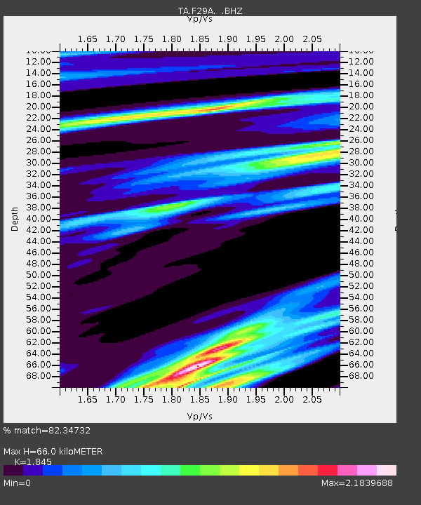
F29A Eureka, SD, USA - Earthquake Result Viewer
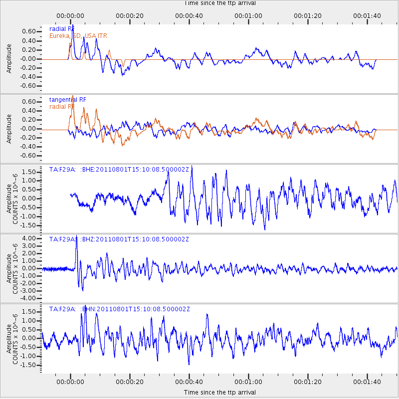
Earthquake location: Near S. Coast Of Honshu, Japan
Earthquake latitude/longitude: 34.6/138.4
Earthquake time(UTC): 2011/08/01 (213) 14:58:09 GMT
Earthquake Depth: 13 km
Earthquake Magnitude: 6.0 MB, 5.6 MS, 5.9 MW, 5.9 MW
Earthquake Catalog/Contributor: WHDF/NEIC
Network: TA USArray Transportable Network (new EarthScope stations)
Station: F29A Eureka, SD, USA
Lat/Lon: 45.83 N/99.83 W
Elevation: 575 m
Distance: 84.2 deg
Az: 36.702 deg
Baz: 315.178 deg
Ray Param: 0.04565066
Estimated Moho Depth: 66.0 km
Estimated Crust Vp/Vs: 1.85
Assumed Crust Vp: 6.53 km/s
Estimated Crust Vs: 3.54 km/s
Estimated Crust Poisson's Ratio: 0.29
Radial Match: 82.34732 %
Radial Bump: 386
Transverse Match: 69.29369 %
Transverse Bump: 400
SOD ConfigId: 408116
Insert Time: 2012-01-01 02:44:14.725 +0000
GWidth: 2.5
Max Bumps: 400
Tol: 0.001

Signal To Noise

ChannelStoNSTALTA
TA:F29A: :BHZ:20110801T15:10:08.500002Z13.8145911.6270651E-61.1777873E-7
TA:F29A: :BHN:20110801T15:10:08.500002Z1.93982785.311313E-72.7380335E-7
TA:F29A: :BHE:20110801T15:10:08.500002Z2.53419457.3701506E-72.9082813E-7
Arrivals
Ps8.8 SECOND
PpPs28 SECOND
PsPs/PpSs37 SECOND