J05D Fort Rock, OR, USA - Earthquake Result Viewer
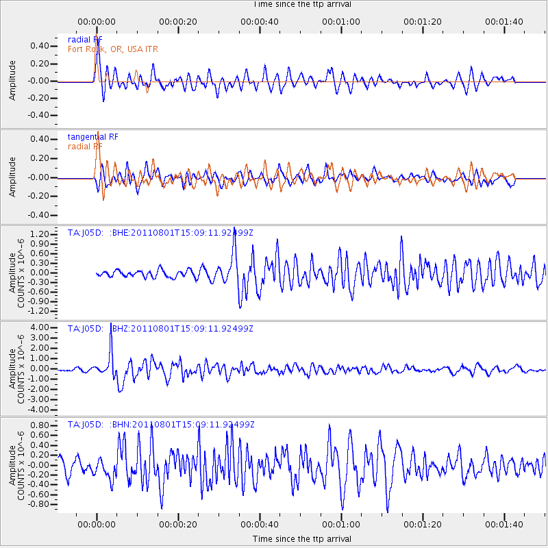
Earthquake location: Near S. Coast Of Honshu, Japan
Earthquake latitude/longitude: 34.6/138.4
Earthquake time(UTC): 2011/08/01 (213) 14:58:09 GMT
Earthquake Depth: 13 km
Earthquake Magnitude: 6.0 MB, 5.6 MS, 5.9 MW, 5.9 MW
Earthquake Catalog/Contributor: WHDF/NEIC
Network: TA USArray Transportable Network (new EarthScope stations)
Station: J05D Fort Rock, OR, USA
Lat/Lon: 43.28 N/121.23 W
Elevation: 1541 m
Distance: 73.8 deg
Az: 48.417 deg
Baz: 302.366 deg
Ray Param: 0.052735932
Estimated Moho Depth: 32.75 km
Estimated Crust Vp/Vs: 1.91
Assumed Crust Vp: 6.597 km/s
Estimated Crust Vs: 3.454 km/s
Estimated Crust Poisson's Ratio: 0.31
Radial Match: 86.537254 %
Radial Bump: 400
Transverse Match: 72.921005 %
Transverse Bump: 400
SOD ConfigId: 408116
Insert Time: 2012-01-01 02:45:44.069 +0000
GWidth: 2.5
Max Bumps: 400
Tol: 0.001

Signal To Noise

ChannelStoNSTALTA
TA:J05D: :BHZ:20110801T15:09:11.92499Z16.1614111.2265637E-67.589459E-8
TA:J05D: :BHN:20110801T15:09:11.92499Z1.27118442.0081812E-71.5797718E-7
TA:J05D: :BHE:20110801T15:09:11.92499Z4.74115324.9049675E-71.0345514E-7
Arrivals
Ps4.7 SECOND
PpPs14 SECOND
PsPs/PpSs19 SECOND