You are here: Home > Network List > UW - Pacific Northwest Regional Seismic Network Stations List
> Station MRBL Marblemount, WA, USA > Earthquake Result Viewer
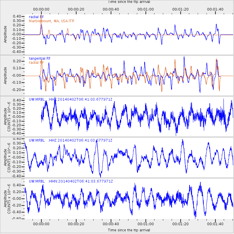
MRBL Marblemount, WA, USA - Earthquake Result Viewer
*The percent match for this event was below the threshold and hence no stack was calculated.
| Earthquake location: |
Near Coast Of Northern Chile |
| Earthquake latitude/longitude: |
-20.1/-70.8 |
| Earthquake time(UTC): |
2014/04/02 (092) 06:29:16 GMT |
| Earthquake Depth: |
15 km |
| Earthquake Magnitude: |
5.2 mb |
| Earthquake Catalog/Contributor: |
ISC/ISC |
|
| Network: |
UW Pacific Northwest Regional Seismic Network |
| Station: |
MRBL Marblemount, WA, USA |
| Lat/Lon: |
48.52 N/121.48 W |
| Elevation: |
75 m |
|
| Distance: |
81.9 deg |
| Az: |
328.718 deg |
| Baz: |
132.789 deg |
| Ray Param: |
$rayparam |
*The percent match for this event was below the threshold and hence was not used in the summary stack. |
|
| Radial Match: |
53.173058 % |
| Radial Bump: |
400 |
| Transverse Match: |
50.353012 % |
| Transverse Bump: |
353 |
| SOD ConfigId: |
3390531 |
| Insert Time: |
2019-04-11 01:22:09.002 +0000 |
| GWidth: |
2.5 |
| Max Bumps: |
400 |
| Tol: |
0.001 |
|
Signal To Noise
| Channel | StoN | STA | LTA |
| UW:MRBL: :HHZ:20140402T06:41:03.677971Z | 0.99872136 | 1.8890942E-7 | 1.8915128E-7 |
| UW:MRBL: :HHN:20140402T06:41:03.677971Z | 1.1347332 | 1.8155676E-7 | 1.5999952E-7 |
| UW:MRBL: :HHE:20140402T06:41:03.677971Z | 0.750639 | 1.1544361E-7 | 1.5379378E-7 |
| Arrivals |
| Ps | |
| PpPs | |
| PsPs/PpSs | |


