O36A Bolckow, MO, USA - Earthquake Result Viewer
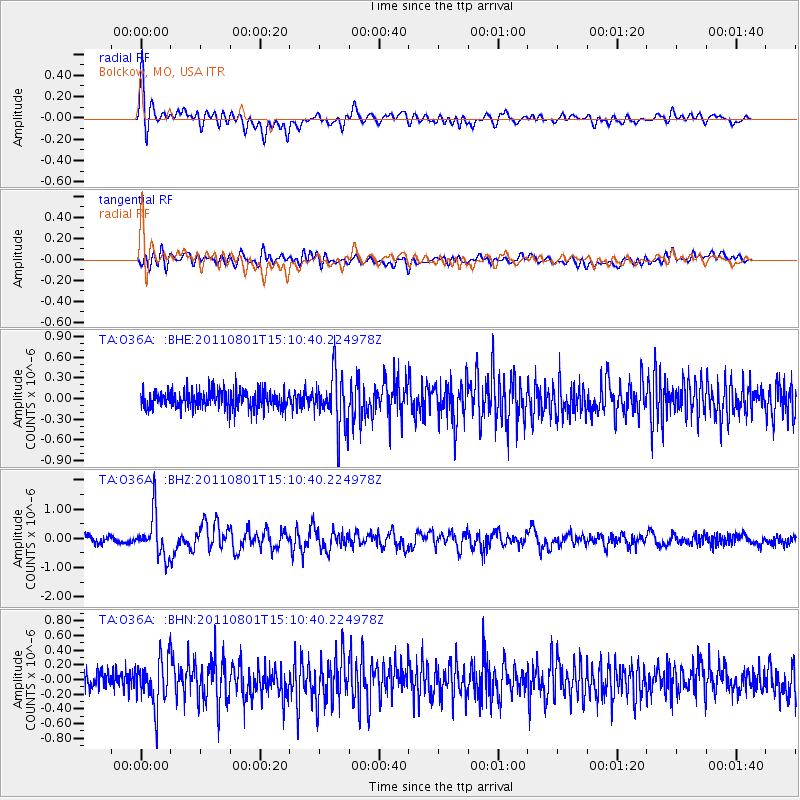
Earthquake location: Near S. Coast Of Honshu, Japan
Earthquake latitude/longitude: 34.6/138.4
Earthquake time(UTC): 2011/08/01 (213) 14:58:09 GMT
Earthquake Depth: 13 km
Earthquake Magnitude: 6.0 MB, 5.6 MS, 5.9 MW, 5.9 MW
Earthquake Catalog/Contributor: WHDF/NEIC
Network: TA USArray Transportable Network (new EarthScope stations)
Station: O36A Bolckow, MO, USA
Lat/Lon: 40.13 N/94.96 W
Elevation: 306 m
Distance: 90.8 deg
Az: 37.992 deg
Baz: 318.544 deg
Ray Param: 0.041647818
Estimated Moho Depth: 33.75 km
Estimated Crust Vp/Vs: 1.72
Assumed Crust Vp: 6.498 km/s
Estimated Crust Vs: 3.778 km/s
Estimated Crust Poisson's Ratio: 0.24
Radial Match: 81.47908 %
Radial Bump: 400
Transverse Match: 64.4896 %
Transverse Bump: 400
SOD ConfigId: 408116
Insert Time: 2012-01-01 02:53:32.172 +0000
GWidth: 2.5
Max Bumps: 400
Tol: 0.001

Signal To Noise

ChannelStoNSTALTA
TA:O36A: :BHZ:20110801T15:10:40.224978Z6.37644347.3384336E-71.1508663E-7
TA:O36A: :BHN:20110801T15:10:40.224978Z2.76266033.1112347E-71.1261734E-7
TA:O36A: :BHE:20110801T15:10:40.224978Z2.96518353.8776096E-71.3077133E-7
Arrivals
Ps3.8 SECOND
PpPs14 SECOND
PsPs/PpSs18 SECOND