You are here: Home > Network List > TA - USArray Transportable Network (new EarthScope stations) Stations List
> Station K33A Hardington, NE, USA > Earthquake Result Viewer
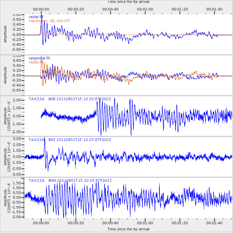
K33A Hardington, NE, USA - Earthquake Result Viewer
*The percent match for this event was below the threshold and hence no stack was calculated.
| Earthquake location: |
Near S. Coast Of Honshu, Japan |
| Earthquake latitude/longitude: |
34.6/138.4 |
| Earthquake time(UTC): |
2011/08/01 (213) 14:58:09 GMT |
| Earthquake Depth: |
13 km |
| Earthquake Magnitude: |
6.0 MB, 5.6 MS, 5.9 MW, 5.9 MW |
| Earthquake Catalog/Contributor: |
WHDF/NEIC |
|
| Network: |
TA USArray Transportable Network (new EarthScope stations) |
| Station: |
K33A Hardington, NE, USA |
| Lat/Lon: |
42.61 N/97.00 W |
| Elevation: |
507 m |
|
| Distance: |
87.9 deg |
| Az: |
37.471 deg |
| Baz: |
317.196 deg |
| Ray Param: |
$rayparam |
*The percent match for this event was below the threshold and hence was not used in the summary stack. |
|
| Radial Match: |
77.64909 % |
| Radial Bump: |
400 |
| Transverse Match: |
81.53595 % |
| Transverse Bump: |
400 |
| SOD ConfigId: |
408116 |
| Insert Time: |
2012-01-01 02:55:48.977 +0000 |
| GWidth: |
2.5 |
| Max Bumps: |
400 |
| Tol: |
0.001 |
|
Signal To Noise
| Channel | StoN | STA | LTA |
| TA:K33A: :BHZ:20110801T15:10:26.875002Z | 7.7558446 | 1.1789641E-6 | 1.5200978E-7 |
| TA:K33A: :BHN:20110801T15:10:26.875002Z | 3.3252602 | 7.0418514E-7 | 2.1176844E-7 |
| TA:K33A: :BHE:20110801T15:10:26.875002Z | 3.5585058 | 1.0658605E-6 | 2.9952471E-7 |
| Arrivals |
| Ps | |
| PpPs | |
| PsPs/PpSs | |


