You are here: Home > Network List > TA - USArray Transportable Network (new EarthScope stations) Stations List
> Station J31A Geddes, SD, USA > Earthquake Result Viewer
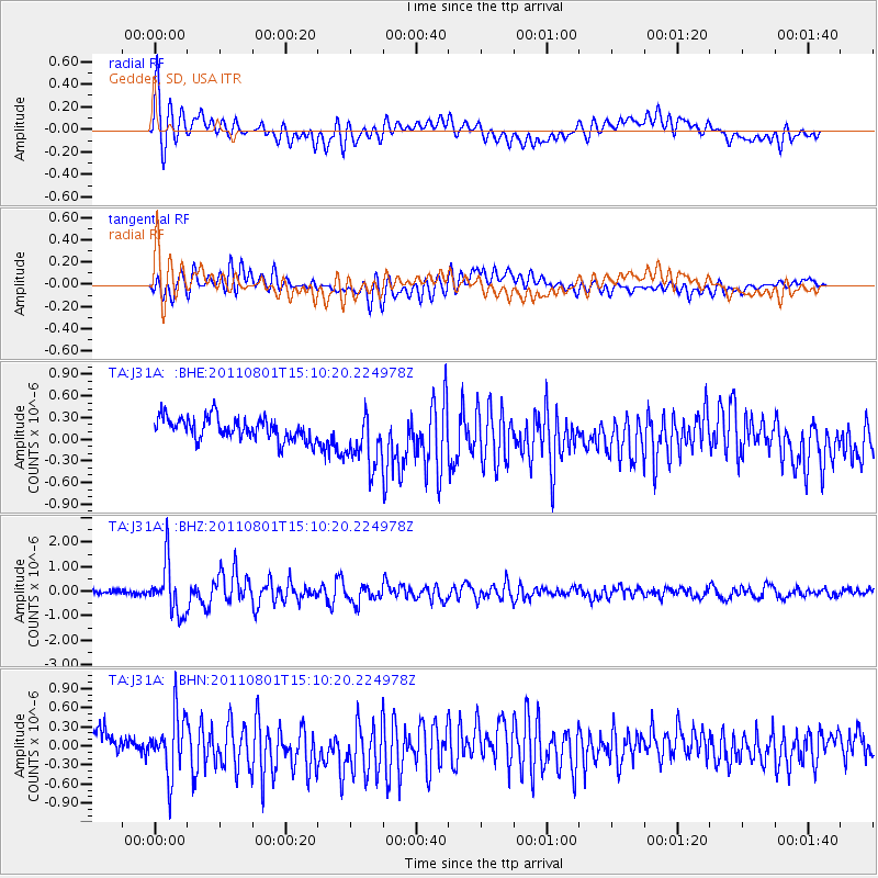
J31A Geddes, SD, USA - Earthquake Result Viewer
*The percent match for this event was below the threshold and hence no stack was calculated.
| Earthquake location: |
Near S. Coast Of Honshu, Japan |
| Earthquake latitude/longitude: |
34.6/138.4 |
| Earthquake time(UTC): |
2011/08/01 (213) 14:58:09 GMT |
| Earthquake Depth: |
13 km |
| Earthquake Magnitude: |
6.0 MB, 5.6 MS, 5.9 MW, 5.9 MW |
| Earthquake Catalog/Contributor: |
WHDF/NEIC |
|
| Network: |
TA USArray Transportable Network (new EarthScope stations) |
| Station: |
J31A Geddes, SD, USA |
| Lat/Lon: |
43.29 N/98.74 W |
| Elevation: |
491 m |
|
| Distance: |
86.6 deg |
| Az: |
37.929 deg |
| Baz: |
316.038 deg |
| Ray Param: |
$rayparam |
*The percent match for this event was below the threshold and hence was not used in the summary stack. |
|
| Radial Match: |
79.34693 % |
| Radial Bump: |
400 |
| Transverse Match: |
66.46841 % |
| Transverse Bump: |
400 |
| SOD ConfigId: |
408116 |
| Insert Time: |
2012-01-01 02:57:09.077 +0000 |
| GWidth: |
2.5 |
| Max Bumps: |
400 |
| Tol: |
0.001 |
|
Signal To Noise
| Channel | StoN | STA | LTA |
| TA:J31A: :BHZ:20110801T15:10:20.224978Z | 13.508792 | 1.0126543E-6 | 7.496261E-8 |
| TA:J31A: :BHN:20110801T15:10:20.224978Z | 2.8684247 | 4.5819664E-7 | 1.5973808E-7 |
| TA:J31A: :BHE:20110801T15:10:20.224978Z | 2.5087872 | 3.892077E-7 | 1.5513781E-7 |
| Arrivals |
| Ps | |
| PpPs | |
| PsPs/PpSs | |


