
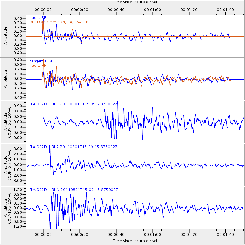
O02D Mt. Diablo Meridian, CA, USA - Earthquake Result Viewer
| ||||||||||||||||||
| ||||||||||||||||||
| ||||||||||||||||||
|
Signal To Noise
| Channel | StoN | STA | LTA |
| TA:O02D: :BHZ:20110801T15:09:15.875002Z | 9.071183 | 1.0388611E-6 | 1.14523225E-7 |
| TA:O02D: :BHN:20110801T15:09:15.875002Z | 4.5540833 | 4.3942194E-7 | 9.6489664E-8 |
| TA:O02D: :BHE:20110801T15:09:15.875002Z | 1.9663634 | 2.5657437E-7 | 1.3048167E-7 |
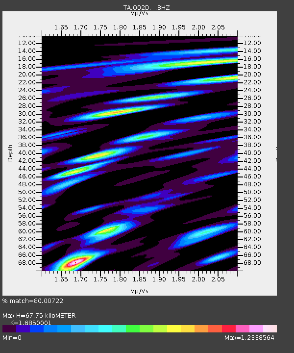
| Arrivals | |
| Ps | 7.3 SECOND |
| PpPs | 27 SECOND |
| PsPs/PpSs | 34 SECOND |

