F31A Hecla, SD, USA - Earthquake Result Viewer
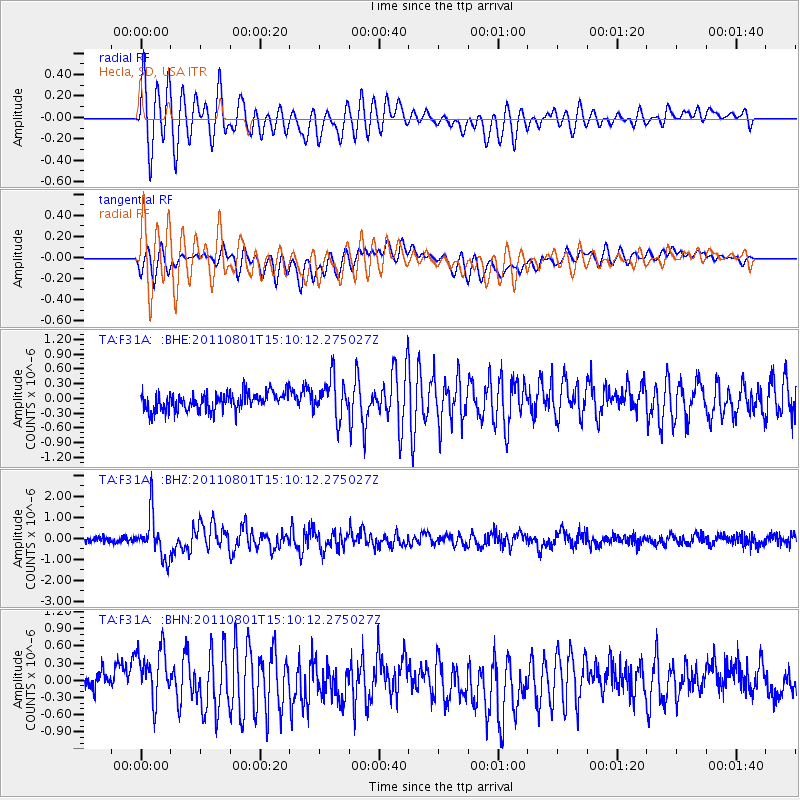
Earthquake location: Near S. Coast Of Honshu, Japan
Earthquake latitude/longitude: 34.6/138.4
Earthquake time(UTC): 2011/08/01 (213) 14:58:09 GMT
Earthquake Depth: 13 km
Earthquake Magnitude: 6.0 MB, 5.6 MS, 5.9 MW, 5.9 MW
Earthquake Catalog/Contributor: WHDF/NEIC
Network: TA USArray Transportable Network (new EarthScope stations)
Station: F31A Hecla, SD, USA
Lat/Lon: 45.86 N/98.25 W
Elevation: 412 m
Distance: 84.9 deg
Az: 35.892 deg
Baz: 316.228 deg
Ray Param: 0.04511487
Estimated Moho Depth: 22.0 km
Estimated Crust Vp/Vs: 1.81
Assumed Crust Vp: 6.53 km/s
Estimated Crust Vs: 3.618 km/s
Estimated Crust Poisson's Ratio: 0.28
Radial Match: 84.53141 %
Radial Bump: 400
Transverse Match: 65.62049 %
Transverse Bump: 400
SOD ConfigId: 408116
Insert Time: 2012-01-01 03:00:28.218 +0000
GWidth: 2.5
Max Bumps: 400
Tol: 0.001

Signal To Noise

ChannelStoNSTALTA
TA:F31A: :BHZ:20110801T15:10:12.275027Z7.4334981.0203389E-61.3726228E-7
TA:F31A: :BHN:20110801T15:10:12.275027Z2.97610125.247304E-71.7631471E-7
TA:F31A: :BHE:20110801T15:10:12.275027Z2.1759213.9752982E-71.8269498E-7
Arrivals
Ps2.8 SECOND
PpPs9.2 SECOND
PsPs/PpSs12 SECOND