
MRBL Marblemount, WA, USA - Earthquake Result Viewer
| ||||||||||||||||||
| ||||||||||||||||||
| ||||||||||||||||||
|
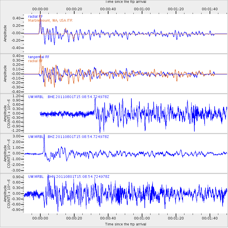
Signal To Noise
| Channel | StoN | STA | LTA |
| UW:MRBL: :BHZ:20110801T15:08:54.724978Z | 18.291826 | 9.3832307E-7 | 5.12974E-8 |
| UW:MRBL: :BHN:20110801T15:08:54.724978Z | 4.1831 | 3.592522E-7 | 8.58818E-8 |
| UW:MRBL: :BHE:20110801T15:08:54.724978Z | 3.8711236 | 3.544675E-7 | 9.156708E-8 |
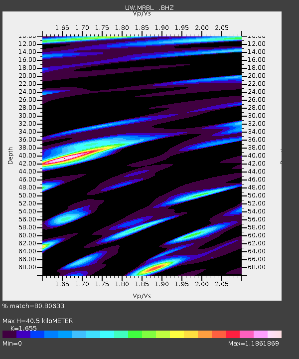
| Arrivals | |
| Ps | 4.2 SECOND |
| PpPs | 16 SECOND |
| PsPs/PpSs | 20 SECOND |

