You are here: Home > Network List > IC - New China Digital Seismograph Network Stations List
> Station ENH Enshi, Hubei Province, China > Earthquake Result Viewer
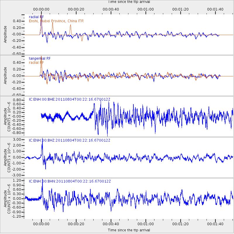
ENH Enshi, Hubei Province, China - Earthquake Result Viewer
*The percent match for this event was below the threshold and hence no stack was calculated.
| Earthquake location: |
Southern Sumatra, Indonesia |
| Earthquake latitude/longitude: |
-2.8/101.1 |
| Earthquake time(UTC): |
2011/08/04 (216) 00:16:07 GMT |
| Earthquake Depth: |
35 km |
| Earthquake Magnitude: |
5.8 MB, 5.5 MS, 5.8 MW, 5.6 MW |
| Earthquake Catalog/Contributor: |
WHDF/NEIC |
|
| Network: |
IC New China Digital Seismograph Network |
| Station: |
ENH Enshi, Hubei Province, China |
| Lat/Lon: |
30.28 N/109.49 E |
| Elevation: |
500 m |
|
| Distance: |
33.9 deg |
| Az: |
13.105 deg |
| Baz: |
195.176 deg |
| Ray Param: |
$rayparam |
*The percent match for this event was below the threshold and hence was not used in the summary stack. |
|
| Radial Match: |
72.809456 % |
| Radial Bump: |
400 |
| Transverse Match: |
64.7004 % |
| Transverse Bump: |
400 |
| SOD ConfigId: |
408116 |
| Insert Time: |
2012-01-01 03:37:34.946 +0000 |
| GWidth: |
2.5 |
| Max Bumps: |
400 |
| Tol: |
0.001 |
|
Signal To Noise
| Channel | StoN | STA | LTA |
| IC:ENH:00:BHZ:20110804T00:22:16.670012Z | 9.091716 | 9.475317E-7 | 1.0421924E-7 |
| IC:ENH:00:BHN:20110804T00:22:16.670012Z | 4.6004043 | 4.4437817E-7 | 9.659546E-8 |
| IC:ENH:00:BHE:20110804T00:22:16.670012Z | 3.7281187 | 3.877361E-7 | 1.04003156E-7 |
| Arrivals |
| Ps | |
| PpPs | |
| PsPs/PpSs | |


