You are here: Home > Network List > G - GEOSCOPE Stations List
> Station CRZF Port Alfred, Crozet, South Indian Ocean > Earthquake Result Viewer
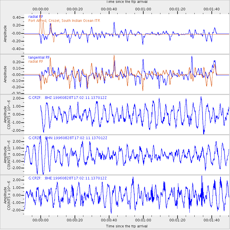
CRZF Port Alfred, Crozet, South Indian Ocean - Earthquake Result Viewer
*The percent match for this event was below the threshold and hence no stack was calculated.
| Earthquake location: |
West Of Macquarie Island |
| Earthquake latitude/longitude: |
-60.0/149.9 |
| Earthquake time(UTC): |
1996/08/28 (241) 16:53:11 GMT |
| Earthquake Depth: |
10 km |
| Earthquake Magnitude: |
6.1 MS, 5.3 MB |
| Earthquake Catalog/Contributor: |
WHDF/NEIC |
|
| Network: |
G GEOSCOPE |
| Station: |
CRZF Port Alfred, Crozet, South Indian Ocean |
| Lat/Lon: |
46.43 S/51.86 E |
| Elevation: |
140 m |
|
| Distance: |
54.9 deg |
| Az: |
236.863 deg |
| Baz: |
142.52 deg |
| Ray Param: |
$rayparam |
*The percent match for this event was below the threshold and hence was not used in the summary stack. |
|
| Radial Match: |
62.750614 % |
| Radial Bump: |
400 |
| Transverse Match: |
62.20341 % |
| Transverse Bump: |
400 |
| SOD ConfigId: |
4480 |
| Insert Time: |
2010-02-26 21:57:17.098 +0000 |
| GWidth: |
2.5 |
| Max Bumps: |
400 |
| Tol: |
0.001 |
|
Signal To Noise
| Channel | StoN | STA | LTA |
| G:CRZF: :BHN:19960828T17:02:11.137012Z | 1.9659979 | 1.9233119E-6 | 9.782879E-7 |
| G:CRZF: :BHE:19960828T17:02:11.137012Z | 0.6621554 | 5.292715E-7 | 7.993162E-7 |
| G:CRZF: :BHZ:19960828T17:02:11.137012Z | 1.3265976 | 1.0087481E-6 | 7.604025E-7 |
| Arrivals |
| Ps | |
| PpPs | |
| PsPs/PpSs | |


