You are here: Home > Network List > CI - Caltech Regional Seismic Network Stations List
> Station SMM Simmler, CA, USA > Earthquake Result Viewer
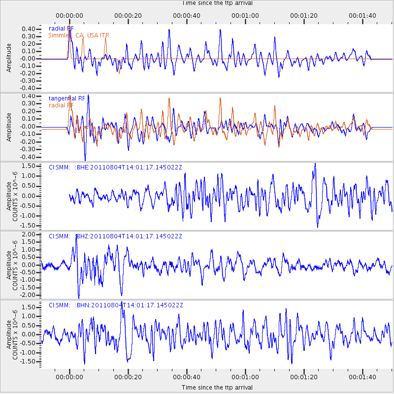
SMM Simmler, CA, USA - Earthquake Result Viewer
*The percent match for this event was below the threshold and hence no stack was calculated.
| Earthquake location: |
Kuril Islands |
| Earthquake latitude/longitude: |
48.8/154.8 |
| Earthquake time(UTC): |
2011/08/04 (216) 13:51:34 GMT |
| Earthquake Depth: |
36 km |
| Earthquake Magnitude: |
6.0 MB, 5.8 MS, 6.1 MW, 6.0 MW |
| Earthquake Catalog/Contributor: |
WHDF/NEIC |
|
| Network: |
CI Caltech Regional Seismic Network |
| Station: |
SMM Simmler, CA, USA |
| Lat/Lon: |
35.31 N/120.00 W |
| Elevation: |
599 m |
|
| Distance: |
61.5 deg |
| Az: |
68.001 deg |
| Baz: |
311.485 deg |
| Ray Param: |
$rayparam |
*The percent match for this event was below the threshold and hence was not used in the summary stack. |
|
| Radial Match: |
67.8026 % |
| Radial Bump: |
400 |
| Transverse Match: |
77.43001 % |
| Transverse Bump: |
400 |
| SOD ConfigId: |
408116 |
| Insert Time: |
2012-01-01 03:49:22.307 +0000 |
| GWidth: |
2.5 |
| Max Bumps: |
400 |
| Tol: |
0.001 |
|
Signal To Noise
| Channel | StoN | STA | LTA |
| CI:SMM: :BHZ:20110804T14:01:17.145022Z | 5.965229 | 9.967542E-7 | 1.6709403E-7 |
| CI:SMM: :BHN:20110804T14:01:17.145022Z | 1.4020813 | 3.782277E-7 | 2.697616E-7 |
| CI:SMM: :BHE:20110804T14:01:17.145022Z | 1.5310415 | 3.517238E-7 | 2.2972844E-7 |
| Arrivals |
| Ps | |
| PpPs | |
| PsPs/PpSs | |


