You are here: Home > Network List > G - GEOSCOPE Stations List
> Station ATD Arta Cave - Arta, Republic of Djibouti > Earthquake Result Viewer
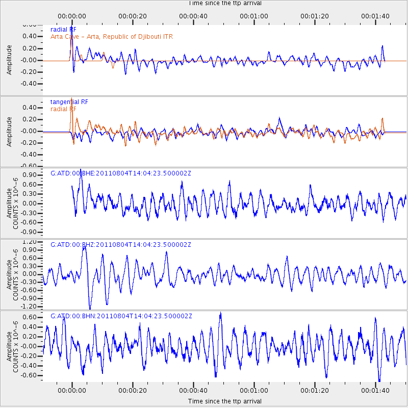
ATD Arta Cave - Arta, Republic of Djibouti - Earthquake Result Viewer
*The percent match for this event was below the threshold and hence no stack was calculated.
| Earthquake location: |
Kuril Islands |
| Earthquake latitude/longitude: |
48.8/154.8 |
| Earthquake time(UTC): |
2011/08/04 (216) 13:51:34 GMT |
| Earthquake Depth: |
36 km |
| Earthquake Magnitude: |
6.0 MB, 5.8 MS, 6.1 MW, 6.0 MW |
| Earthquake Catalog/Contributor: |
WHDF/NEIC |
|
| Network: |
G GEOSCOPE |
| Station: |
ATD Arta Cave - Arta, Republic of Djibouti |
| Lat/Lon: |
11.53 N/42.85 E |
| Elevation: |
610 m |
|
| Distance: |
95.3 deg |
| Az: |
294.057 deg |
| Baz: |
37.998 deg |
| Ray Param: |
$rayparam |
*The percent match for this event was below the threshold and hence was not used in the summary stack. |
|
| Radial Match: |
61.705437 % |
| Radial Bump: |
400 |
| Transverse Match: |
45.3351 % |
| Transverse Bump: |
400 |
| SOD ConfigId: |
408116 |
| Insert Time: |
2012-01-01 03:51:55.642 +0000 |
| GWidth: |
2.5 |
| Max Bumps: |
400 |
| Tol: |
0.001 |
|
Signal To Noise
| Channel | StoN | STA | LTA |
| G:ATD:00:BHZ:20110804T14:04:23.500002Z | 2.3569467 | 5.185911E-7 | 2.2002666E-7 |
| G:ATD:00:BHN:20110804T14:04:23.500002Z | 1.4885539 | 2.9961743E-7 | 2.0128087E-7 |
| G:ATD:00:BHE:20110804T14:04:23.500002Z | 0.7781948 | 2.2117692E-7 | 2.8421795E-7 |
| Arrivals |
| Ps | |
| PpPs | |
| PsPs/PpSs | |


