You are here: Home > Network List > TA - USArray Transportable Network (new EarthScope stations) Stations List
> Station G05D Wamic, OR, USA > Earthquake Result Viewer
G05D Wamic, OR, USA - Earthquake Result Viewer
*The percent match for this event was below the threshold and hence no stack was calculated.
| Earthquake location: |
Kuril Islands |
| Earthquake latitude/longitude: |
48.8/154.8 |
| Earthquake time(UTC): |
2011/08/04 (216) 13:51:34 GMT |
| Earthquake Depth: |
36 km |
| Earthquake Magnitude: |
6.0 MB, 5.8 MS, 6.1 MW, 6.0 MW |
| Earthquake Catalog/Contributor: |
WHDF/NEIC |
|
| Network: |
TA USArray Transportable Network (new EarthScope stations) |
| Station: |
G05D Wamic, OR, USA |
| Lat/Lon: |
45.24 N/121.32 W |
| Elevation: |
592 m |
|
| Distance: |
54.5 deg |
| Az: |
59.645 deg |
| Baz: |
306.191 deg |
| Ray Param: |
$rayparam |
*The percent match for this event was below the threshold and hence was not used in the summary stack. |
|
| Radial Match: |
85.90218 % |
| Radial Bump: |
380 |
| Transverse Match: |
81.836815 % |
| Transverse Bump: |
400 |
| SOD ConfigId: |
408116 |
| Insert Time: |
2012-01-01 04:05:33.192 +0000 |
| GWidth: |
2.5 |
| Max Bumps: |
400 |
| Tol: |
0.001 |
|
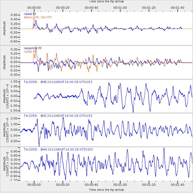
Signal To Noise
| Channel | StoN | STA | LTA |
| TA:G05D: :BHZ:20110804T14:00:28.075015Z | 7.403148 | 1.179953E-6 | 1.5938528E-7 |
| TA:G05D: :BHN:20110804T14:00:28.075015Z | 1.8633381 | 2.4973664E-7 | 1.3402648E-7 |
| TA:G05D: :BHE:20110804T14:00:28.075015Z | 2.3706675 | 3.4947524E-7 | 1.474164E-7 |
| Arrivals |
| Ps | |
| PpPs | |
| PsPs/PpSs | |


