You are here: Home > Network List > TA - USArray Transportable Network (new EarthScope stations) Stations List
> Station 635A Leesville, TX, USA > Earthquake Result Viewer
635A Leesville, TX, USA - Earthquake Result Viewer
*The percent match for this event was below the threshold and hence no stack was calculated.
| Earthquake location: |
Kuril Islands |
| Earthquake latitude/longitude: |
48.8/154.8 |
| Earthquake time(UTC): |
2011/08/04 (216) 13:51:34 GMT |
| Earthquake Depth: |
36 km |
| Earthquake Magnitude: |
6.0 MB, 5.8 MS, 6.1 MW, 6.0 MW |
| Earthquake Catalog/Contributor: |
WHDF/NEIC |
|
| Network: |
TA USArray Transportable Network (new EarthScope stations) |
| Station: |
635A Leesville, TX, USA |
| Lat/Lon: |
29.39 N/97.77 W |
| Elevation: |
119 m |
|
| Distance: |
78.8 deg |
| Az: |
58.055 deg |
| Baz: |
320.024 deg |
| Ray Param: |
$rayparam |
*The percent match for this event was below the threshold and hence was not used in the summary stack. |
|
| Radial Match: |
71.791954 % |
| Radial Bump: |
400 |
| Transverse Match: |
63.72309 % |
| Transverse Bump: |
400 |
| SOD ConfigId: |
408116 |
| Insert Time: |
2012-01-01 04:09:27.945 +0000 |
| GWidth: |
2.5 |
| Max Bumps: |
400 |
| Tol: |
0.001 |
|
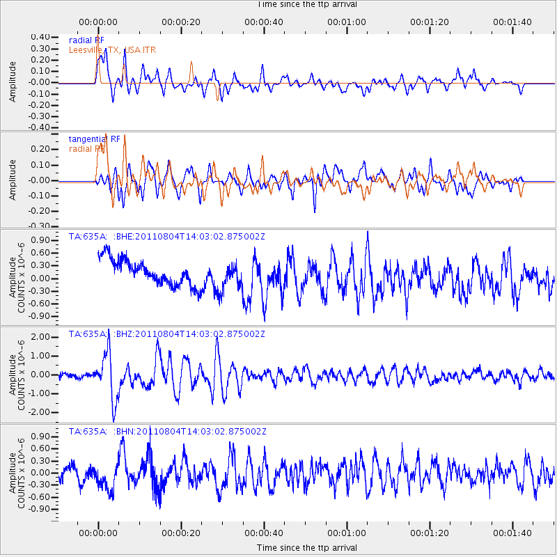
Signal To Noise
| Channel | StoN | STA | LTA |
| TA:635A: :BHZ:20110804T14:03:02.875002Z | 13.427317 | 1.256919E-6 | 9.360909E-8 |
| TA:635A: :BHN:20110804T14:03:02.875002Z | 2.2398543 | 3.4561583E-7 | 1.5430282E-7 |
| TA:635A: :BHE:20110804T14:03:02.875002Z | 1.0667036 | 3.2048428E-7 | 3.0044362E-7 |
| Arrivals |
| Ps | |
| PpPs | |
| PsPs/PpSs | |


