You are here: Home > Network List > TA - USArray Transportable Network (new EarthScope stations) Stations List
> Station V60A Jim Taylor Road, Stokes, NC, USA > Earthquake Result Viewer
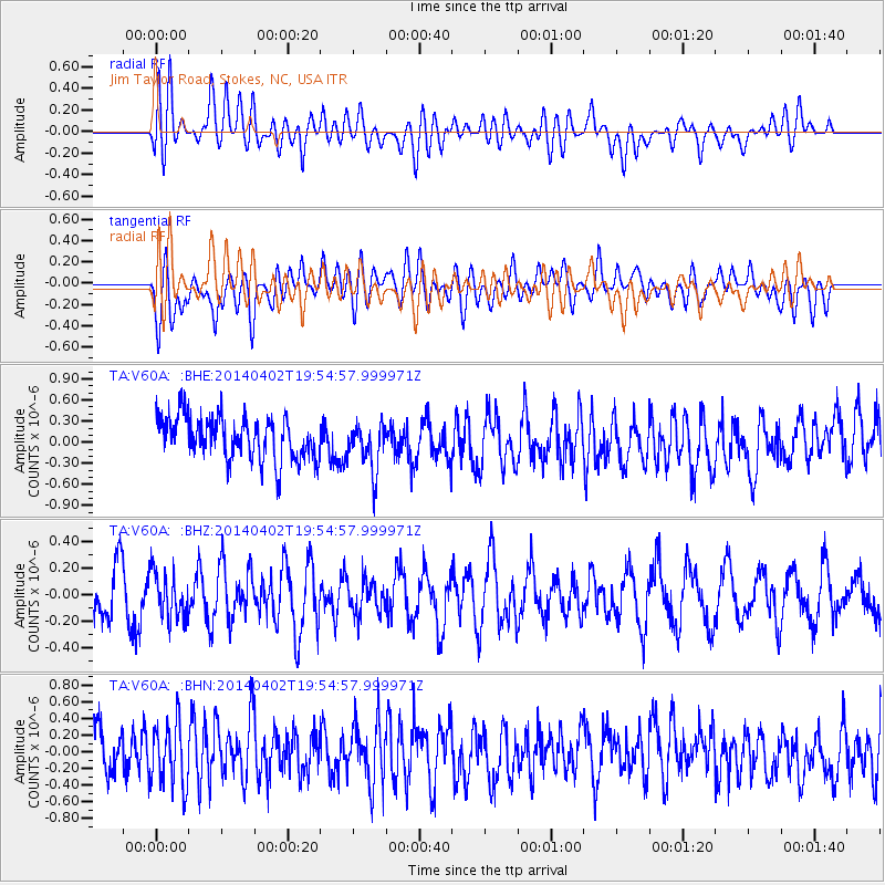
V60A Jim Taylor Road, Stokes, NC, USA - Earthquake Result Viewer
*The percent match for this event was below the threshold and hence no stack was calculated.
| Earthquake location: |
Near Coast Of Northern Chile |
| Earthquake latitude/longitude: |
-20.4/-70.6 |
| Earthquake time(UTC): |
2014/04/02 (092) 19:45:49 GMT |
| Earthquake Depth: |
17 km |
| Earthquake Magnitude: |
5.3 MW |
| Earthquake Catalog/Contributor: |
ISC/ISC |
|
| Network: |
TA USArray Transportable Network (new EarthScope stations) |
| Station: |
V60A Jim Taylor Road, Stokes, NC, USA |
| Lat/Lon: |
35.76 N/77.26 W |
| Elevation: |
8.0 m |
|
| Distance: |
56.2 deg |
| Az: |
353.453 deg |
| Baz: |
172.445 deg |
| Ray Param: |
$rayparam |
*The percent match for this event was below the threshold and hence was not used in the summary stack. |
|
| Radial Match: |
47.173237 % |
| Radial Bump: |
400 |
| Transverse Match: |
59.29588 % |
| Transverse Bump: |
400 |
| SOD ConfigId: |
3390531 |
| Insert Time: |
2019-04-11 01:46:17.549 +0000 |
| GWidth: |
2.5 |
| Max Bumps: |
400 |
| Tol: |
0.001 |
|
Signal To Noise
| Channel | StoN | STA | LTA |
| TA:V60A: :BHZ:20140402T19:54:57.999971Z | 0.8511811 | 1.7081656E-7 | 2.0068181E-7 |
| TA:V60A: :BHN:20140402T19:54:57.999971Z | 1.22036 | 3.7850603E-7 | 3.1015932E-7 |
| TA:V60A: :BHE:20140402T19:54:57.999971Z | 1.1013908 | 3.379422E-7 | 3.0683222E-7 |
| Arrivals |
| Ps | |
| PpPs | |
| PsPs/PpSs | |


