You are here: Home > Network List > TA - USArray Transportable Network (new EarthScope stations) Stations List
> Station X43A Marvell, AR, USA > Earthquake Result Viewer
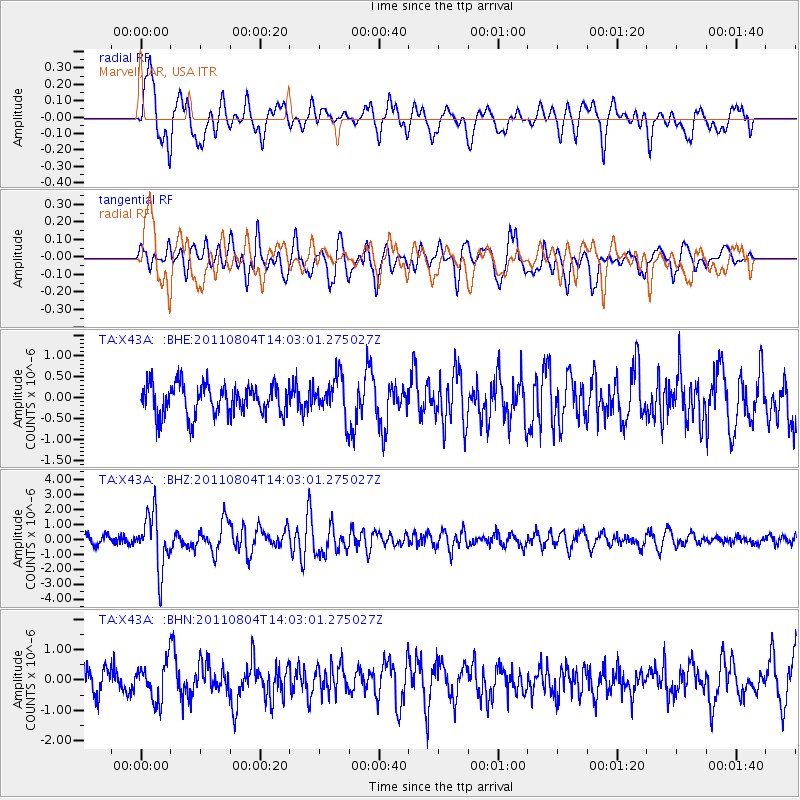
X43A Marvell, AR, USA - Earthquake Result Viewer
*The percent match for this event was below the threshold and hence no stack was calculated.
| Earthquake location: |
Kuril Islands |
| Earthquake latitude/longitude: |
48.8/154.8 |
| Earthquake time(UTC): |
2011/08/04 (216) 13:51:34 GMT |
| Earthquake Depth: |
36 km |
| Earthquake Magnitude: |
6.0 MB, 5.8 MS, 6.1 MW, 6.0 MW |
| Earthquake Catalog/Contributor: |
WHDF/NEIC |
|
| Network: |
TA USArray Transportable Network (new EarthScope stations) |
| Station: |
X43A Marvell, AR, USA |
| Lat/Lon: |
34.52 N/90.88 W |
| Elevation: |
53 m |
|
| Distance: |
78.6 deg |
| Az: |
50.133 deg |
| Baz: |
322.106 deg |
| Ray Param: |
$rayparam |
*The percent match for this event was below the threshold and hence was not used in the summary stack. |
|
| Radial Match: |
75.11358 % |
| Radial Bump: |
400 |
| Transverse Match: |
78.102356 % |
| Transverse Bump: |
400 |
| SOD ConfigId: |
408116 |
| Insert Time: |
2012-01-01 04:43:30.028 +0000 |
| GWidth: |
2.5 |
| Max Bumps: |
400 |
| Tol: |
0.001 |
|
Signal To Noise
| Channel | StoN | STA | LTA |
| TA:X43A: :BHZ:20110804T14:03:01.275027Z | 7.1965375 | 1.8452744E-6 | 2.5641143E-7 |
| TA:X43A: :BHN:20110804T14:03:01.275027Z | 1.7398645 | 6.170089E-7 | 3.5463043E-7 |
| TA:X43A: :BHE:20110804T14:03:01.275027Z | 1.2766445 | 4.7142214E-7 | 3.692666E-7 |
| Arrivals |
| Ps | |
| PpPs | |
| PsPs/PpSs | |


