You are here: Home > Network List > TA - USArray Transportable Network (new EarthScope stations) Stations List
> Station M42A Sheffield, IL, USA > Earthquake Result Viewer
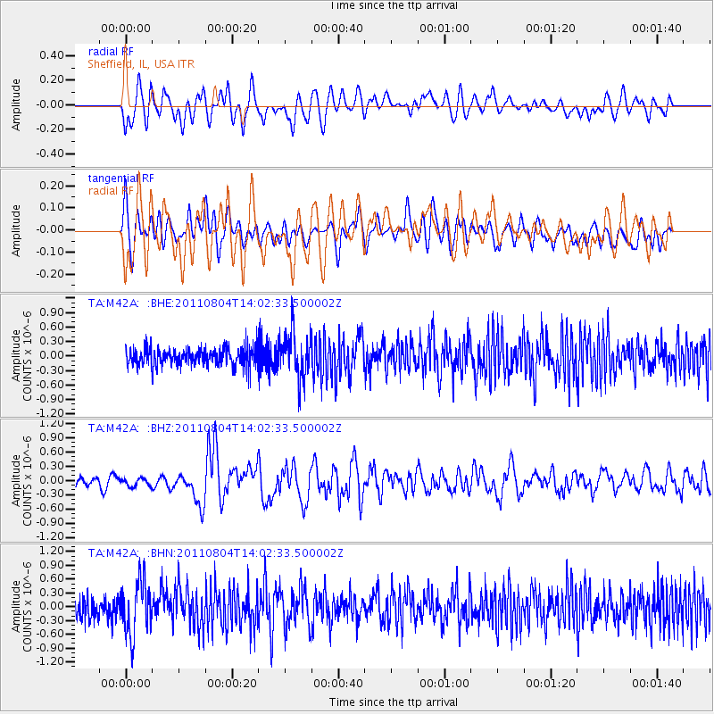
M42A Sheffield, IL, USA - Earthquake Result Viewer
*The percent match for this event was below the threshold and hence no stack was calculated.
| Earthquake location: |
Kuril Islands |
| Earthquake latitude/longitude: |
48.8/154.8 |
| Earthquake time(UTC): |
2011/08/04 (216) 13:51:34 GMT |
| Earthquake Depth: |
36 km |
| Earthquake Magnitude: |
6.0 MB, 5.8 MS, 6.1 MW, 6.0 MW |
| Earthquake Catalog/Contributor: |
WHDF/NEIC |
|
| Network: |
TA USArray Transportable Network (new EarthScope stations) |
| Station: |
M42A Sheffield, IL, USA |
| Lat/Lon: |
41.45 N/89.76 W |
| Elevation: |
212 m |
|
| Distance: |
73.7 deg |
| Az: |
45.007 deg |
| Baz: |
321.563 deg |
| Ray Param: |
$rayparam |
*The percent match for this event was below the threshold and hence was not used in the summary stack. |
|
| Radial Match: |
37.399685 % |
| Radial Bump: |
400 |
| Transverse Match: |
53.461407 % |
| Transverse Bump: |
400 |
| SOD ConfigId: |
408116 |
| Insert Time: |
2012-01-01 04:46:48.327 +0000 |
| GWidth: |
2.5 |
| Max Bumps: |
400 |
| Tol: |
0.001 |
|
Signal To Noise
| Channel | StoN | STA | LTA |
| TA:M42A: :BHZ:20110804T14:02:33.500002Z | 0.88569725 | 8.6860304E-8 | 9.8069975E-8 |
| TA:M42A: :BHN:20110804T14:02:33.500002Z | 3.1482167 | 5.8854965E-7 | 1.8694699E-7 |
| TA:M42A: :BHE:20110804T14:02:33.500002Z | 2.6076293 | 4.8014914E-7 | 1.8413245E-7 |
| Arrivals |
| Ps | |
| PpPs | |
| PsPs/PpSs | |


