You are here: Home > Network List > UW - Pacific Northwest Regional Seismic Network Stations List
> Station HOOD Mt Hood Meadows, OR CREST BB SMO > Earthquake Result Viewer
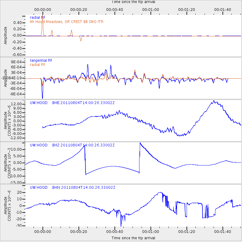
HOOD Mt Hood Meadows, OR CREST BB SMO - Earthquake Result Viewer
*The percent match for this event was below the threshold and hence no stack was calculated.
| Earthquake location: |
Kuril Islands |
| Earthquake latitude/longitude: |
48.8/154.8 |
| Earthquake time(UTC): |
2011/08/04 (216) 13:51:34 GMT |
| Earthquake Depth: |
36 km |
| Earthquake Magnitude: |
6.0 MB, 5.8 MS, 6.1 MW, 6.0 MW |
| Earthquake Catalog/Contributor: |
WHDF/NEIC |
|
| Network: |
UW Pacific Northwest Regional Seismic Network |
| Station: |
HOOD Mt Hood Meadows, OR CREST BB SMO |
| Lat/Lon: |
45.32 N/121.65 W |
| Elevation: |
1520 m |
|
| Distance: |
54.3 deg |
| Az: |
59.739 deg |
| Baz: |
306.007 deg |
| Ray Param: |
$rayparam |
*The percent match for this event was below the threshold and hence was not used in the summary stack. |
|
| Radial Match: |
71.64953 % |
| Radial Bump: |
370 |
| Transverse Match: |
87.62569 % |
| Transverse Bump: |
338 |
| SOD ConfigId: |
408116 |
| Insert Time: |
2012-01-01 04:49:21.509 +0000 |
| GWidth: |
2.5 |
| Max Bumps: |
400 |
| Tol: |
0.001 |
|
Signal To Noise
| Channel | StoN | STA | LTA |
| UW:HOOD: :BHZ:20110804T14:00:26.33002Z | 0.7764216 | 9.244519E-4 | 0.0011906571 |
| UW:HOOD: :BHN:20110804T14:00:26.33002Z | 1.8057624 | 9.253703E-6 | 5.1245406E-6 |
| UW:HOOD: :BHE:20110804T14:00:26.33002Z | 4.1817946 | 5.4572292E-6 | 1.304997E-6 |
| Arrivals |
| Ps | |
| PpPs | |
| PsPs/PpSs | |


