You are here: Home > Network List > TA - USArray Transportable Network (new EarthScope stations) Stations List
> Station J04D Umpqua National Forest, Toketee, OR, USA > Earthquake Result Viewer
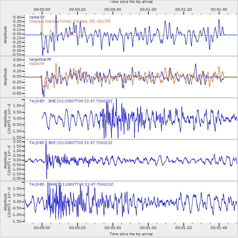
J04D Umpqua National Forest, Toketee, OR, USA - Earthquake Result Viewer
*The percent match for this event was below the threshold and hence no stack was calculated.
| Earthquake location: |
Santa Cruz Islands Region |
| Earthquake latitude/longitude: |
-11.8/168.3 |
| Earthquake time(UTC): |
2011/08/07 (219) 06:22:34 GMT |
| Earthquake Depth: |
403 km |
| Earthquake Magnitude: |
5.7 MB, 5.7 MW, 5.7 MW |
| Earthquake Catalog/Contributor: |
WHDF/NEIC |
|
| Network: |
TA USArray Transportable Network (new EarthScope stations) |
| Station: |
J04D Umpqua National Forest, Toketee, OR, USA |
| Lat/Lon: |
43.24 N/122.11 W |
| Elevation: |
1948 m |
|
| Distance: |
83.6 deg |
| Az: |
43.561 deg |
| Baz: |
247.423 deg |
| Ray Param: |
$rayparam |
*The percent match for this event was below the threshold and hence was not used in the summary stack. |
|
| Radial Match: |
42.903175 % |
| Radial Bump: |
400 |
| Transverse Match: |
69.09118 % |
| Transverse Bump: |
400 |
| SOD ConfigId: |
410809 |
| Insert Time: |
2012-01-04 00:59:03.558 +0000 |
| GWidth: |
2.5 |
| Max Bumps: |
400 |
| Tol: |
0.001 |
|
Signal To Noise
| Channel | StoN | STA | LTA |
| TA:J04D: :BHZ:20110807T06:33:47.700029Z | 3.4130082 | 6.336643E-7 | 1.8566152E-7 |
| TA:J04D: :BHN:20110807T06:33:47.700029Z | 1.4327492 | 5.069916E-7 | 3.5385932E-7 |
| TA:J04D: :BHE:20110807T06:33:47.700029Z | 1.0450685 | 4.0543702E-7 | 3.8795255E-7 |
| Arrivals |
| Ps | |
| PpPs | |
| PsPs/PpSs | |


