You are here: Home > Network List > UW - Pacific Northwest Regional Seismic Network Stations List
> Station LEBA Lebam, WA, USA > Earthquake Result Viewer
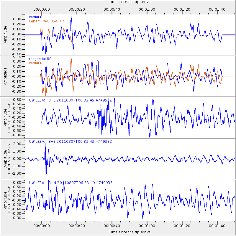
LEBA Lebam, WA, USA - Earthquake Result Viewer
*The percent match for this event was below the threshold and hence no stack was calculated.
| Earthquake location: |
Santa Cruz Islands Region |
| Earthquake latitude/longitude: |
-11.8/168.3 |
| Earthquake time(UTC): |
2011/08/07 (219) 06:22:34 GMT |
| Earthquake Depth: |
403 km |
| Earthquake Magnitude: |
5.7 MB, 5.7 MW, 5.7 MW |
| Earthquake Catalog/Contributor: |
WHDF/NEIC |
|
| Network: |
UW Pacific Northwest Regional Seismic Network |
| Station: |
LEBA Lebam, WA, USA |
| Lat/Lon: |
46.55 N/123.56 W |
| Elevation: |
73 m |
|
| Distance: |
84.0 deg |
| Az: |
40.096 deg |
| Baz: |
246.026 deg |
| Ray Param: |
$rayparam |
*The percent match for this event was below the threshold and hence was not used in the summary stack. |
|
| Radial Match: |
51.213093 % |
| Radial Bump: |
400 |
| Transverse Match: |
52.66832 % |
| Transverse Bump: |
400 |
| SOD ConfigId: |
410809 |
| Insert Time: |
2012-01-04 01:02:03.575 +0000 |
| GWidth: |
2.5 |
| Max Bumps: |
400 |
| Tol: |
0.001 |
|
Signal To Noise
| Channel | StoN | STA | LTA |
| UW:LEBA: :BHZ:20110807T06:33:49.474993Z | 6.156545 | 8.573953E-7 | 1.3926567E-7 |
| UW:LEBA: :BHN:20110807T06:33:49.474993Z | 1.1000962 | 2.9723583E-7 | 2.7019072E-7 |
| UW:LEBA: :BHE:20110807T06:33:49.474993Z | 1.5222995 | 3.347992E-7 | 2.1992992E-7 |
| Arrivals |
| Ps | |
| PpPs | |
| PsPs/PpSs | |


