DRV Dumont d'Urville, Terre Adelie (Antartica) - Earthquake Result Viewer
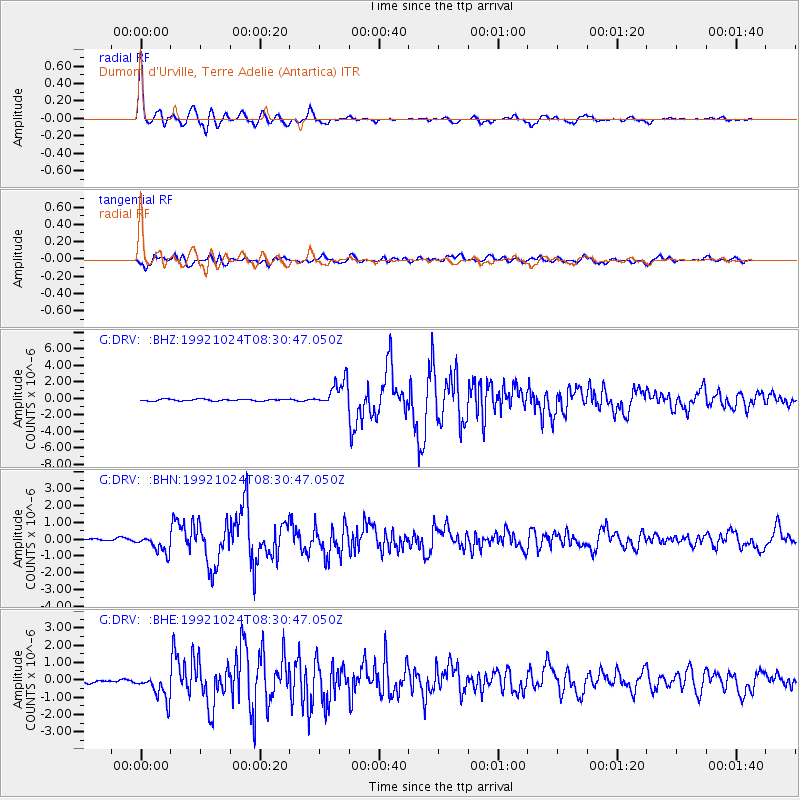
Earthquake location: Kermadec Islands, New Zealand
Earthquake latitude/longitude: -29.4/-177.4
Earthquake time(UTC): 1992/10/24 (298) 08:23:04 GMT
Earthquake Depth: 41 km
Earthquake Magnitude: 5.8 MB, 6.2 MS, 6.6 UNKNOWN
Earthquake Catalog/Contributor: WHDF/NEIC
Network: G GEOSCOPE
Station: DRV Dumont d'Urville, Terre Adelie (Antartica)
Lat/Lon: 66.67 S/140.01 E
Elevation: 40 m
Distance: 45.2 deg
Az: 202.324 deg
Baz: 56.281 deg
Ray Param: 0.07131664
Estimated Moho Depth: 21.5 km
Estimated Crust Vp/Vs: 1.69
Assumed Crust Vp: 6.39 km/s
Estimated Crust Vs: 3.775 km/s
Estimated Crust Poisson's Ratio: 0.23
Radial Match: 96.99658 %
Radial Bump: 386
Transverse Match: 89.12462 %
Transverse Bump: 400
SOD ConfigId: 16938
Insert Time: 2010-02-26 21:59:15.845 +0000
GWidth: 2.5
Max Bumps: 400
Tol: 0.001

Signal To Noise

ChannelStoNSTALTA
G:DRV: :BHN:19921024T08:30:47.050Z3.51310254.9128124E-71.3984256E-7
G:DRV: :BHE:19921024T08:30:47.050Z6.1576757.7595246E-71.2601387E-7
G:DRV: :BHZ:19921024T08:30:47.050Z14.6591511.6011452E-61.0922496E-7
Arrivals
Ps2.5 SECOND
PpPs8.5 SECOND
PsPs/PpSs11 SECOND