You are here: Home > Network List > TA - USArray Transportable Network (new EarthScope stations) Stations List
> Station 338A Crockett, TX, USA > Earthquake Result Viewer
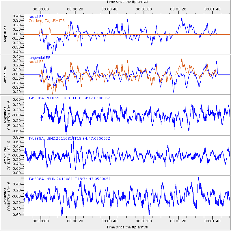
338A Crockett, TX, USA - Earthquake Result Viewer
*The percent match for this event was below the threshold and hence no stack was calculated.
| Earthquake location: |
Eastern Honshu, Japan |
| Earthquake latitude/longitude: |
37.0/140.9 |
| Earthquake time(UTC): |
2011/08/11 (223) 18:22:04 GMT |
| Earthquake Depth: |
44 km |
| Earthquake Magnitude: |
6.0 MB, 5.3 MS, 5.9 MW, 5.9 MW |
| Earthquake Catalog/Contributor: |
WHDF/NEIC |
|
| Network: |
TA USArray Transportable Network (new EarthScope stations) |
| Station: |
338A Crockett, TX, USA |
| Lat/Lon: |
31.36 N/95.31 W |
| Elevation: |
137 m |
|
| Distance: |
94.0 deg |
| Az: |
45.454 deg |
| Baz: |
318.191 deg |
| Ray Param: |
$rayparam |
*The percent match for this event was below the threshold and hence was not used in the summary stack. |
|
| Radial Match: |
46.312817 % |
| Radial Bump: |
400 |
| Transverse Match: |
49.2838 % |
| Transverse Bump: |
400 |
| SOD ConfigId: |
410809 |
| Insert Time: |
2012-01-04 01:54:48.282 +0000 |
| GWidth: |
2.5 |
| Max Bumps: |
400 |
| Tol: |
0.001 |
|
Signal To Noise
| Channel | StoN | STA | LTA |
| TA:338A: :BHZ:20110811T18:34:47.050005Z | 2.3115644 | 2.67326E-7 | 1.1564721E-7 |
| TA:338A: :BHN:20110811T18:34:47.050005Z | 0.9697778 | 1.5860549E-7 | 1.6354826E-7 |
| TA:338A: :BHE:20110811T18:34:47.050005Z | 0.5064015 | 1.18941834E-7 | 2.3487655E-7 |
| Arrivals |
| Ps | |
| PpPs | |
| PsPs/PpSs | |


