DRV Dumont d'Urville, Terre Adelie (Antartica) - Earthquake Result Viewer
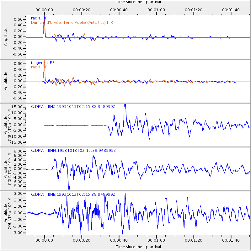
Earthquake location: Eastern New Guinea Reg., P.N.G.
Earthquake latitude/longitude: -5.9/146.0
Earthquake time(UTC): 1993/10/13 (286) 02:06:00 GMT
Earthquake Depth: 24 km
Earthquake Magnitude: 6.4 MB, 7.1 MS, 6.7 UNKNOWN, 7.1 ML
Earthquake Catalog/Contributor: WHDF/NEIC
Network: G GEOSCOPE
Station: DRV Dumont d'Urville, Terre Adelie (Antartica)
Lat/Lon: 66.67 S/140.01 E
Elevation: 40 m
Distance: 60.8 deg
Az: 182.743 deg
Baz: 6.864 deg
Ray Param: 0.061274096
Estimated Moho Depth: 19.75 km
Estimated Crust Vp/Vs: 1.83
Assumed Crust Vp: 6.39 km/s
Estimated Crust Vs: 3.492 km/s
Estimated Crust Poisson's Ratio: 0.29
Radial Match: 96.56844 %
Radial Bump: 366
Transverse Match: 91.284035 %
Transverse Bump: 400
SOD ConfigId: 16938
Insert Time: 2010-02-26 22:00:13.645 +0000
GWidth: 2.5
Max Bumps: 400
Tol: 0.001

Signal To Noise

ChannelStoNSTALTA
G:DRV: :BHN:19931013T02:15:38.948999Z2.4693124.0303527E-71.6321765E-7
G:DRV: :BHE:19931013T02:15:38.948999Z0.76602951.4823964E-71.935169E-7
G:DRV: :BHZ:19931013T02:15:38.948999Z5.1444348.0707787E-71.568837E-7
Arrivals
Ps2.7 SECOND
PpPs8.4 SECOND
PsPs/PpSs11 SECOND