DRV Dumont d'Urville, Terre Adelie (Antartica) - Earthquake Result Viewer
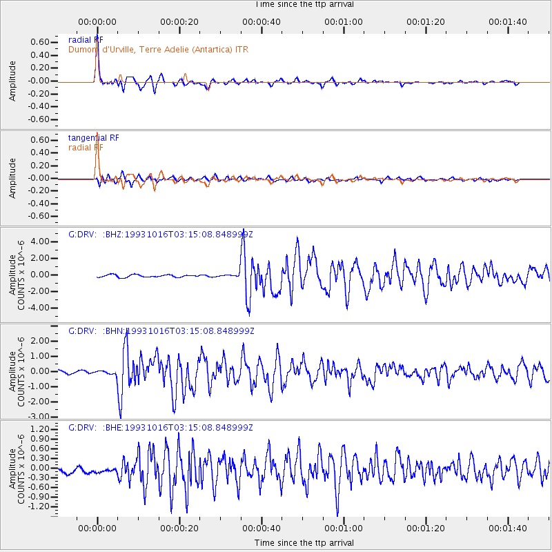
Earthquake location: Eastern New Guinea Reg., P.N.G.
Earthquake latitude/longitude: -5.9/146.2
Earthquake time(UTC): 1993/10/16 (289) 03:05:31 GMT
Earthquake Depth: 33 km
Earthquake Magnitude: 6.2 MB, 6.4 MS, 6.5 UNKNOWN, 6.3 MW
Earthquake Catalog/Contributor: WHDF/NEIC
Network: G GEOSCOPE
Station: DRV Dumont d'Urville, Terre Adelie (Antartica)
Lat/Lon: 66.67 S/140.01 E
Elevation: 40 m
Distance: 60.8 deg
Az: 182.822 deg
Baz: 7.061 deg
Ray Param: 0.061255
Estimated Moho Depth: 49.75 km
Estimated Crust Vp/Vs: 2.06
Assumed Crust Vp: 6.39 km/s
Estimated Crust Vs: 3.109 km/s
Estimated Crust Poisson's Ratio: 0.34
Radial Match: 95.253975 %
Radial Bump: 374
Transverse Match: 79.12312 %
Transverse Bump: 400
SOD ConfigId: 16938
Insert Time: 2010-02-26 22:00:16.502 +0000
GWidth: 2.5
Max Bumps: 400
Tol: 0.001

Signal To Noise

ChannelStoNSTALTA
G:DRV: :BHN:19931016T03:15:08.848999Z1.00910221.76668E-71.7507442E-7
G:DRV: :BHE:19931016T03:15:08.848999Z0.869039651.6895554E-71.9441637E-7
G:DRV: :BHZ:19931016T03:15:08.848999Z1.74981272.5611968E-71.4636976E-7
Arrivals
Ps8.5 SECOND
PpPs23 SECOND
PsPs/PpSs31 SECOND