You are here: Home > Network List > TA - USArray Transportable Network (new EarthScope stations) Stations List
> Station F35A Swanville, MN, USA > Earthquake Result Viewer
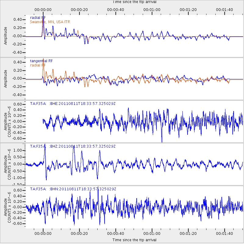
F35A Swanville, MN, USA - Earthquake Result Viewer
*The percent match for this event was below the threshold and hence no stack was calculated.
| Earthquake location: |
Eastern Honshu, Japan |
| Earthquake latitude/longitude: |
37.0/140.9 |
| Earthquake time(UTC): |
2011/08/11 (223) 18:22:04 GMT |
| Earthquake Depth: |
44 km |
| Earthquake Magnitude: |
6.0 MB, 5.3 MS, 5.9 MW, 5.9 MW |
| Earthquake Catalog/Contributor: |
WHDF/NEIC |
|
| Network: |
TA USArray Transportable Network (new EarthScope stations) |
| Station: |
F35A Swanville, MN, USA |
| Lat/Lon: |
45.86 N/94.57 W |
| Elevation: |
376 m |
|
| Distance: |
83.6 deg |
| Az: |
35.404 deg |
| Baz: |
318.442 deg |
| Ray Param: |
$rayparam |
*The percent match for this event was below the threshold and hence was not used in the summary stack. |
|
| Radial Match: |
71.931564 % |
| Radial Bump: |
400 |
| Transverse Match: |
68.42121 % |
| Transverse Bump: |
400 |
| SOD ConfigId: |
410809 |
| Insert Time: |
2012-01-04 02:06:26.900 +0000 |
| GWidth: |
2.5 |
| Max Bumps: |
400 |
| Tol: |
0.001 |
|
Signal To Noise
| Channel | StoN | STA | LTA |
| TA:F35A: :BHZ:20110811T18:33:57.325029Z | 7.6044703 | 5.426335E-7 | 7.135717E-8 |
| TA:F35A: :BHN:20110811T18:33:57.325029Z | 2.335894 | 2.2344852E-7 | 9.565867E-8 |
| TA:F35A: :BHE:20110811T18:33:57.325029Z | 1.6514463 | 1.7795375E-7 | 1.077563E-7 |
| Arrivals |
| Ps | |
| PpPs | |
| PsPs/PpSs | |


