You are here: Home > Network List > TA - USArray Transportable Network (new EarthScope stations) Stations List
> Station 146A Union, MS, USA > Earthquake Result Viewer
146A Union, MS, USA - Earthquake Result Viewer
*The percent match for this event was below the threshold and hence no stack was calculated.
| Earthquake location: |
Eastern Honshu, Japan |
| Earthquake latitude/longitude: |
37.0/140.9 |
| Earthquake time(UTC): |
2011/08/11 (223) 18:22:04 GMT |
| Earthquake Depth: |
44 km |
| Earthquake Magnitude: |
6.0 MB, 5.3 MS, 5.9 MW, 5.9 MW |
| Earthquake Catalog/Contributor: |
WHDF/NEIC |
|
| Network: |
TA USArray Transportable Network (new EarthScope stations) |
| Station: |
146A Union, MS, USA |
| Lat/Lon: |
32.64 N/89.06 W |
| Elevation: |
164 m |
|
| Distance: |
96.5 deg |
| Az: |
40.542 deg |
| Baz: |
321.941 deg |
| Ray Param: |
$rayparam |
*The percent match for this event was below the threshold and hence was not used in the summary stack. |
|
| Radial Match: |
40.018574 % |
| Radial Bump: |
261 |
| Transverse Match: |
54.288456 % |
| Transverse Bump: |
347 |
| SOD ConfigId: |
410809 |
| Insert Time: |
2012-01-04 02:13:57.759 +0000 |
| GWidth: |
2.5 |
| Max Bumps: |
400 |
| Tol: |
0.001 |
|
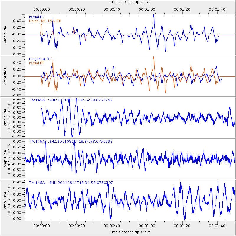
Signal To Noise
| Channel | StoN | STA | LTA |
| TA:146A: :BHZ:20110811T18:34:58.075029Z | 2.807541 | 3.3840706E-7 | 1.2053503E-7 |
| TA:146A: :BHN:20110811T18:34:58.075029Z | 0.4976384 | 2.7496836E-7 | 5.5254645E-7 |
| TA:146A: :BHE:20110811T18:34:58.075029Z | 0.4371075 | 2.5472724E-7 | 5.827565E-7 |
| Arrivals |
| Ps | |
| PpPs | |
| PsPs/PpSs | |


