You are here: Home > Network List > TA - USArray Transportable Network (new EarthScope stations) Stations List
> Station Z46A Louisville, MS, USA > Earthquake Result Viewer
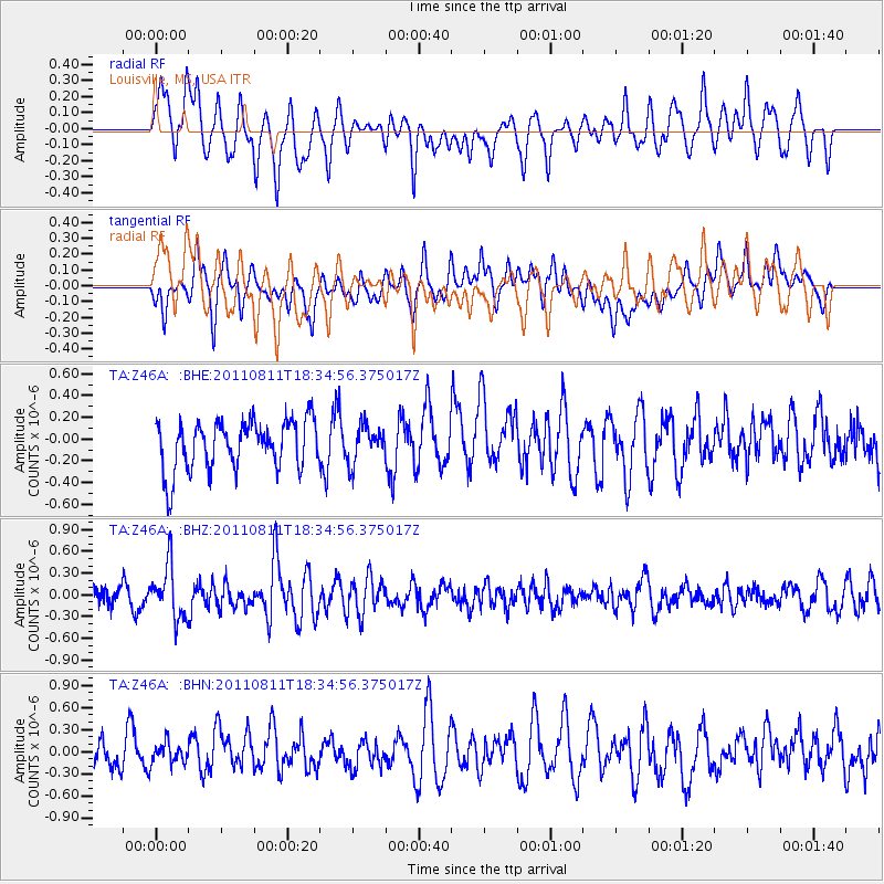
Z46A Louisville, MS, USA - Earthquake Result Viewer
*The percent match for this event was below the threshold and hence no stack was calculated.
| Earthquake location: |
Eastern Honshu, Japan |
| Earthquake latitude/longitude: |
37.0/140.9 |
| Earthquake time(UTC): |
2011/08/11 (223) 18:22:04 GMT |
| Earthquake Depth: |
44 km |
| Earthquake Magnitude: |
6.0 MB, 5.3 MS, 5.9 MW, 5.9 MW |
| Earthquake Catalog/Contributor: |
WHDF/NEIC |
|
| Network: |
TA USArray Transportable Network (new EarthScope stations) |
| Station: |
Z46A Louisville, MS, USA |
| Lat/Lon: |
33.19 N/88.94 W |
| Elevation: |
125 m |
|
| Distance: |
96.1 deg |
| Az: |
40.121 deg |
| Baz: |
322.05 deg |
| Ray Param: |
$rayparam |
*The percent match for this event was below the threshold and hence was not used in the summary stack. |
|
| Radial Match: |
55.94629 % |
| Radial Bump: |
400 |
| Transverse Match: |
53.15157 % |
| Transverse Bump: |
400 |
| SOD ConfigId: |
410809 |
| Insert Time: |
2012-01-04 02:15:42.606 +0000 |
| GWidth: |
2.5 |
| Max Bumps: |
400 |
| Tol: |
0.001 |
|
Signal To Noise
| Channel | StoN | STA | LTA |
| TA:Z46A: :BHZ:20110811T18:34:56.375017Z | 2.8374357 | 3.6262E-7 | 1.2779849E-7 |
| TA:Z46A: :BHN:20110811T18:34:56.375017Z | 0.5860761 | 1.4143153E-7 | 2.413194E-7 |
| TA:Z46A: :BHE:20110811T18:34:56.375017Z | 0.7394939 | 1.6706737E-7 | 2.2592123E-7 |
| Arrivals |
| Ps | |
| PpPs | |
| PsPs/PpSs | |


