You are here: Home > Network List > TA - USArray Transportable Network (new EarthScope stations) Stations List
> Station R41A Rosebud, MO, USA > Earthquake Result Viewer
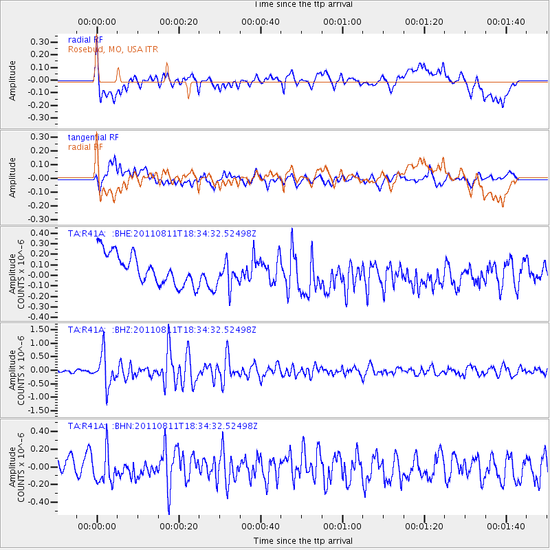
R41A Rosebud, MO, USA - Earthquake Result Viewer
*The percent match for this event was below the threshold and hence no stack was calculated.
| Earthquake location: |
Eastern Honshu, Japan |
| Earthquake latitude/longitude: |
37.0/140.9 |
| Earthquake time(UTC): |
2011/08/11 (223) 18:22:04 GMT |
| Earthquake Depth: |
44 km |
| Earthquake Magnitude: |
6.0 MB, 5.3 MS, 5.9 MW, 5.9 MW |
| Earthquake Catalog/Contributor: |
WHDF/NEIC |
|
| Network: |
TA USArray Transportable Network (new EarthScope stations) |
| Station: |
R41A Rosebud, MO, USA |
| Lat/Lon: |
38.30 N/91.38 W |
| Elevation: |
257 m |
|
| Distance: |
90.9 deg |
| Az: |
38.491 deg |
| Baz: |
320.729 deg |
| Ray Param: |
$rayparam |
*The percent match for this event was below the threshold and hence was not used in the summary stack. |
|
| Radial Match: |
48.731453 % |
| Radial Bump: |
400 |
| Transverse Match: |
65.14644 % |
| Transverse Bump: |
400 |
| SOD ConfigId: |
410809 |
| Insert Time: |
2012-01-04 02:19:25.600 +0000 |
| GWidth: |
2.5 |
| Max Bumps: |
400 |
| Tol: |
0.001 |
|
Signal To Noise
| Channel | StoN | STA | LTA |
| TA:R41A: :BHZ:20110811T18:34:32.52498Z | 6.7800355 | 5.9680434E-7 | 8.802378E-8 |
| TA:R41A: :BHN:20110811T18:34:32.52498Z | 1.664902 | 1.7432555E-7 | 1.04706196E-7 |
| TA:R41A: :BHE:20110811T18:34:32.52498Z | 0.8900221 | 1.2923353E-7 | 1.452026E-7 |
| Arrivals |
| Ps | |
| PpPs | |
| PsPs/PpSs | |


