
GNW Green Mountain (BB) - Earthquake Result Viewer
| ||||||||||||||||||
| ||||||||||||||||||
| ||||||||||||||||||
|
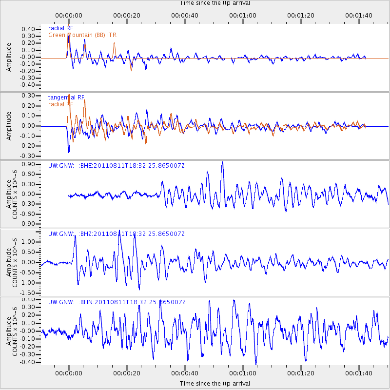
Signal To Noise
| Channel | StoN | STA | LTA |
| UW:GNW: :BHZ:20110811T18:32:25.865007Z | 8.20692 | 5.6341844E-7 | 6.865164E-8 |
| UW:GNW: :BHN:20110811T18:32:25.865007Z | 1.2610803 | 7.904451E-8 | 6.268E-8 |
| UW:GNW: :BHE:20110811T18:32:25.865007Z | 3.3684723 | 1.84444E-7 | 5.4755983E-8 |
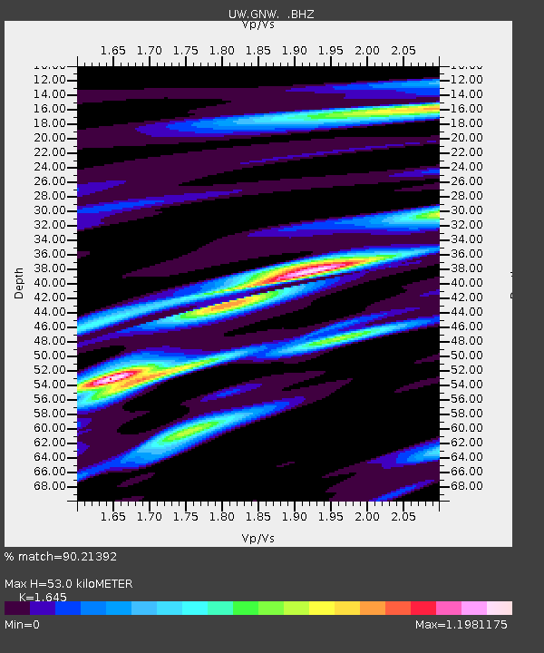
| Arrivals | |
| Ps | 5.4 SECOND |
| PpPs | 20 SECOND |
| PsPs/PpSs | 26 SECOND |

