MDND Maddock, ND, USA - Earthquake Result Viewer
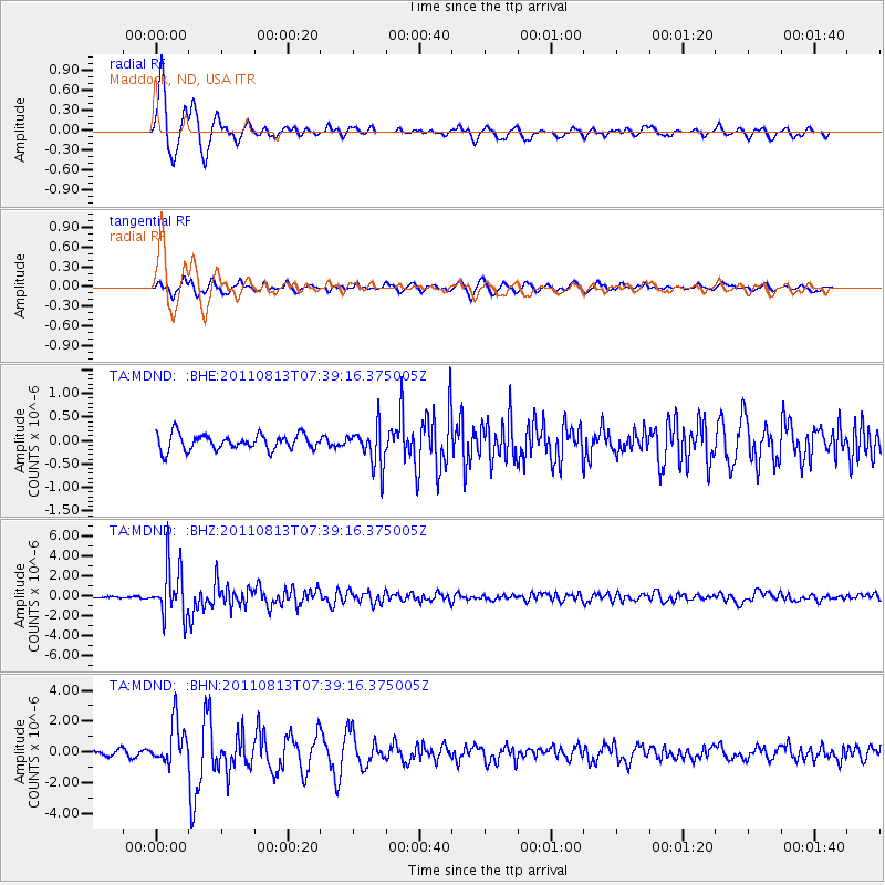
Earthquake location: Off Coast Of Chiapas, Mexico
Earthquake latitude/longitude: 14.4/-94.7
Earthquake time(UTC): 2011/08/13 (225) 07:33:06 GMT
Earthquake Depth: 6.0 km
Earthquake Magnitude: 5.7 MB, 5.2 MS, 5.8 MW, 5.6 MW
Earthquake Catalog/Contributor: WHDF/NEIC
Network: TA USArray Transportable Network (new EarthScope stations)
Station: MDND Maddock, ND, USA
Lat/Lon: 47.85 N/99.60 W
Elevation: 479 m
Distance: 33.6 deg
Az: 353.998 deg
Baz: 171.348 deg
Ray Param: 0.078138806
Estimated Moho Depth: 16.25 km
Estimated Crust Vp/Vs: 1.60
Assumed Crust Vp: 6.53 km/s
Estimated Crust Vs: 4.082 km/s
Estimated Crust Poisson's Ratio: 0.18
Radial Match: 94.13864 %
Radial Bump: 368
Transverse Match: 82.75987 %
Transverse Bump: 400
SOD ConfigId: 410809
Insert Time: 2012-01-06 04:50:29.568 +0000
GWidth: 2.5
Max Bumps: 400
Tol: 0.001

Signal To Noise

ChannelStoNSTALTA
TA:MDND: :BHZ:20110813T07:39:16.375005Z38.530482.570833E-66.6722066E-8
TA:MDND: :BHN:20110813T07:39:16.375005Z7.104181.3628862E-61.9184286E-7
TA:MDND: :BHE:20110813T07:39:16.375005Z2.50614864.196109E-71.6743256E-7
Arrivals
Ps1.6 SECOND
PpPs5.9 SECOND
PsPs/PpSs7.5 SECOND