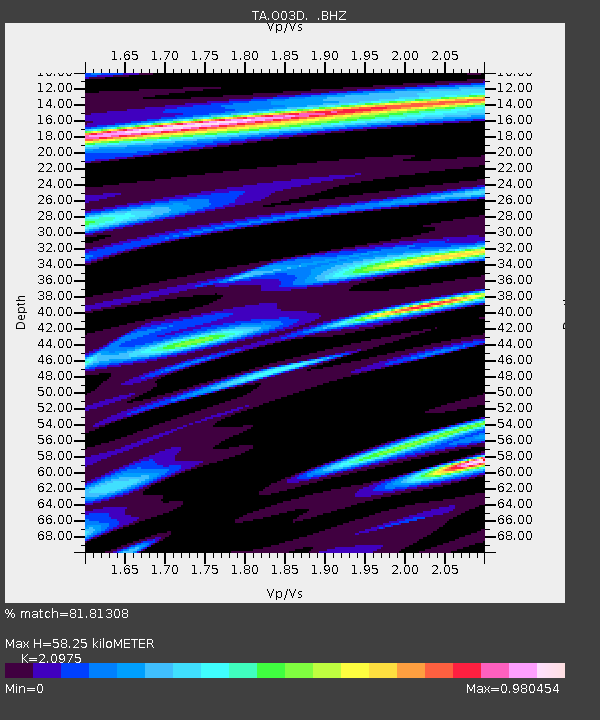
O03D Paynes Creek, CA, USA - Earthquake Result Viewer
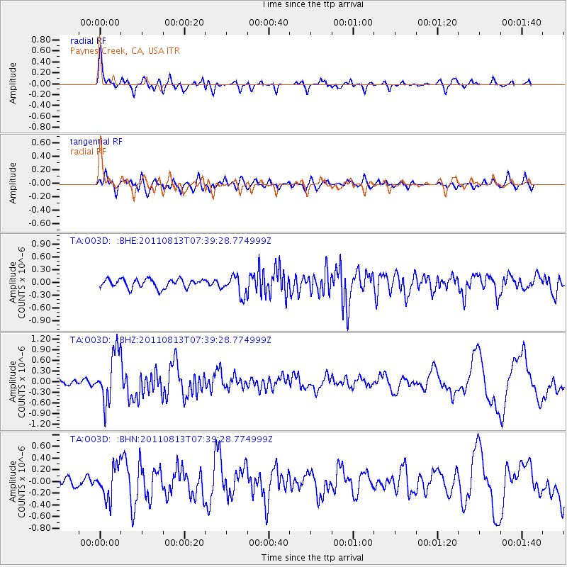
Earthquake location: Off Coast Of Chiapas, Mexico
Earthquake latitude/longitude: 14.4/-94.7
Earthquake time(UTC): 2011/08/13 (225) 07:33:06 GMT
Earthquake Depth: 6.0 km
Earthquake Magnitude: 5.7 MB, 5.2 MS, 5.8 MW, 5.6 MW
Earthquake Catalog/Contributor: WHDF/NEIC
Network: TA USArray Transportable Network (new EarthScope stations)
Station: O03D Paynes Creek, CA, USA
Lat/Lon: 40.29 N/121.80 W
Elevation: 968 m
Distance: 35.0 deg
Az: 322.594 deg
Baz: 129.684 deg
Ray Param: 0.07744021
Estimated Moho Depth: 58.25 km
Estimated Crust Vp/Vs: 2.10
Assumed Crust Vp: 6.566 km/s
Estimated Crust Vs: 3.13 km/s
Estimated Crust Poisson's Ratio: 0.35
Radial Match: 81.81308 %
Radial Bump: 400
Transverse Match: 57.31274 %
Transverse Bump: 400
SOD ConfigId: 410809
Insert Time: 2012-01-06 04:53:09.675 +0000
GWidth: 2.5
Max Bumps: 400
Tol: 0.001

Signal To Noise

ChannelStoNSTALTA
TA:O03D: :BHZ:20110813T07:39:28.774999Z9.9785097.0705795E-77.085808E-8
TA:O03D: :BHN:20110813T07:39:28.774999Z2.64881752.7629153E-71.04307496E-7
TA:O03D: :BHE:20110813T07:39:28.774999Z2.2687972.3314755E-71.02762634E-7
Arrivals
Ps10 SECOND
PpPs26 SECOND
PsPs/PpSs36 SECOND