
DRV Dumont d'Urville, Terre Adelie (Antartica) - Earthquake Result Viewer
| ||||||||||||||||||
| ||||||||||||||||||
| ||||||||||||||||||
|
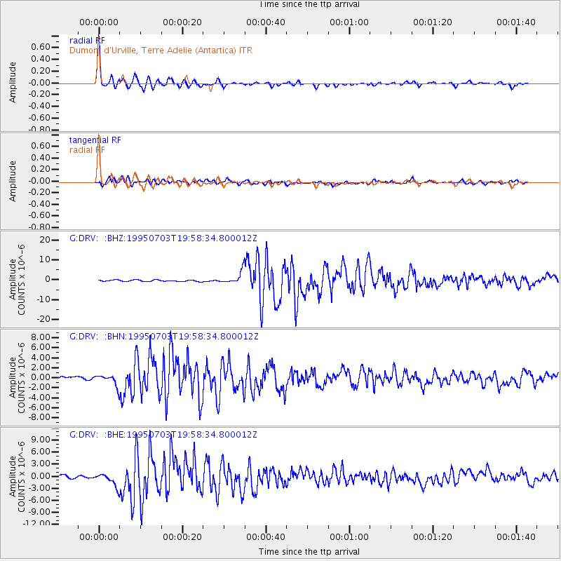
Signal To Noise
| Channel | StoN | STA | LTA |
| G:DRV: :BHN:19950703T19:58:34.800012Z | 1.7042522 | 1.0993773E-6 | 6.45079E-7 |
| G:DRV: :BHE:19950703T19:58:34.800012Z | 3.3431268 | 1.8716968E-6 | 5.5986413E-7 |
| G:DRV: :BHZ:19950703T19:58:34.800012Z | 9.188082 | 3.2691205E-6 | 3.558001E-7 |
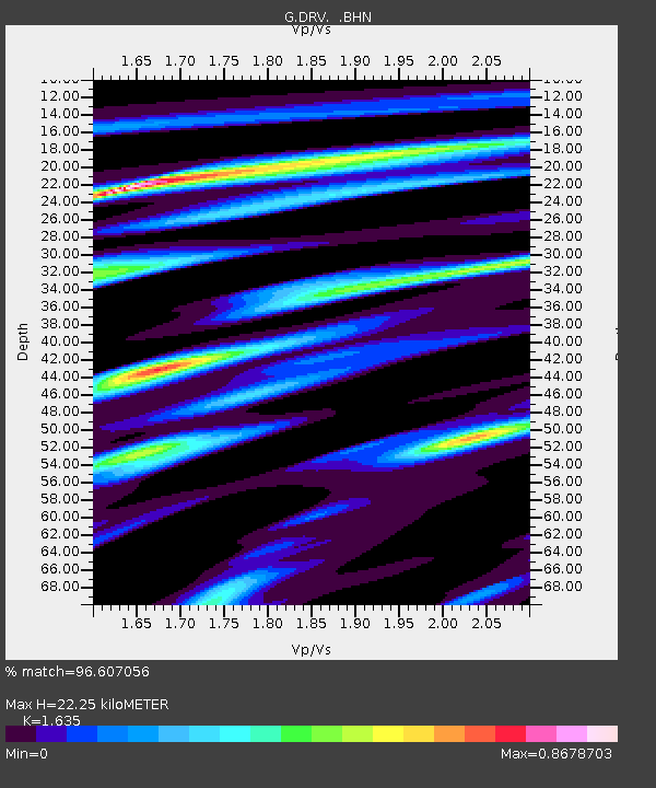
| Arrivals | |
| Ps | 2.4 SECOND |
| PpPs | 8.6 SECOND |
| PsPs/PpSs | 11 SECOND |

