DRV Dumont d'Urville, Terre Adelie (Antartica) - Earthquake Result Viewer
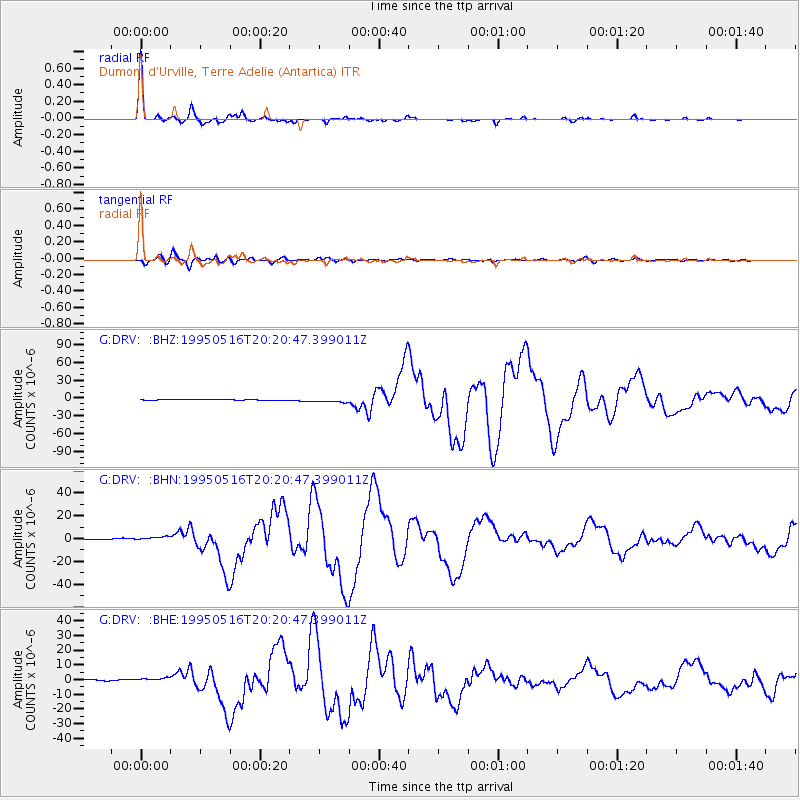
Earthquake location: Southeast Of Loyalty Islands
Earthquake latitude/longitude: -23.0/169.9
Earthquake time(UTC): 1995/05/16 (136) 20:12:45 GMT
Earthquake Depth: 33 km
Earthquake Magnitude: 6.8 MB, 7.7 MS, 7.7 UNKNOWN, 7.7 MW
Earthquake Catalog/Contributor: WHDF/NEIC
Network: G GEOSCOPE
Station: DRV Dumont d'Urville, Terre Adelie (Antartica)
Lat/Lon: 66.67 S/140.01 E
Elevation: 40 m
Distance: 47.6 deg
Az: 195.6 deg
Baz: 38.462 deg
Ray Param: 0.06984595
Estimated Moho Depth: 20.5 km
Estimated Crust Vp/Vs: 1.84
Assumed Crust Vp: 6.39 km/s
Estimated Crust Vs: 3.468 km/s
Estimated Crust Poisson's Ratio: 0.29
Radial Match: 98.87258 %
Radial Bump: 199
Transverse Match: 94.412415 %
Transverse Bump: 400
SOD ConfigId: 6273
Insert Time: 2010-02-26 22:01:34.749 +0000
GWidth: 2.5
Max Bumps: 400
Tol: 0.001

Signal To Noise

ChannelStoNSTALTA
G:DRV: :BHN:19950516T20:20:47.399011Z6.4806021.8881033E-62.913469E-7
G:DRV: :BHE:19950516T20:20:47.399011Z3.7055541.3736869E-63.7071027E-7
G:DRV: :BHZ:19950516T20:20:47.399011Z7.45027353.23509E-64.342243E-7
Arrivals
Ps2.9 SECOND
PpPs8.6 SECOND
PsPs/PpSs11 SECOND