
D34A Park Rapids, MN, USA - Earthquake Result Viewer
| ||||||||||||||||||
| ||||||||||||||||||
| ||||||||||||||||||
|
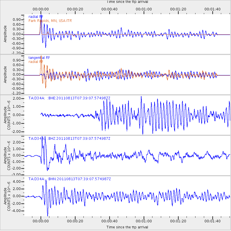
Signal To Noise
| Channel | StoN | STA | LTA |
| TA:D34A: :BHZ:20110813T07:39:07.574987Z | 34.67102 | 1.5804716E-6 | 4.55848E-8 |
| TA:D34A: :BHN:20110813T07:39:07.574987Z | 28.624447 | 2.3065409E-6 | 8.0579404E-8 |
| TA:D34A: :BHE:20110813T07:39:07.574987Z | 3.1196635 | 2.8286433E-7 | 9.067143E-8 |
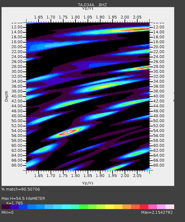
| Arrivals | |
| Ps | 7.0 SECOND |
| PpPs | 22 SECOND |
| PsPs/PpSs | 29 SECOND |

