D36A Goodland, MN, USA - Earthquake Result Viewer
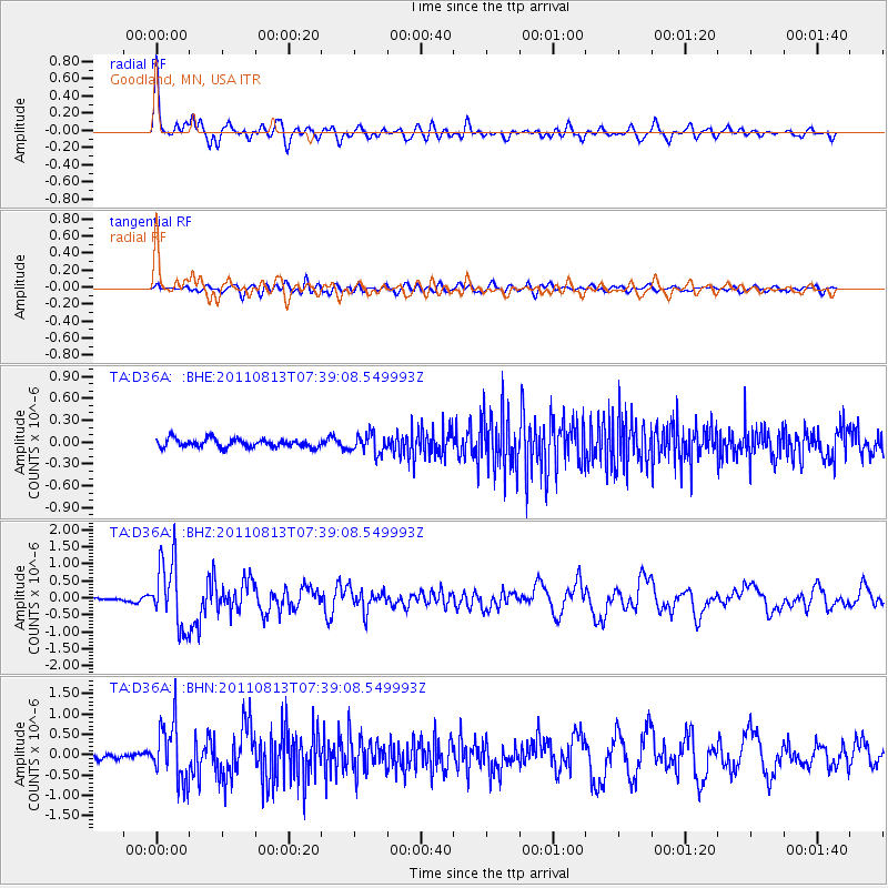
Earthquake location: Off Coast Of Chiapas, Mexico
Earthquake latitude/longitude: 14.4/-94.7
Earthquake time(UTC): 2011/08/13 (225) 07:33:06 GMT
Earthquake Depth: 6.0 km
Earthquake Magnitude: 5.7 MB, 5.2 MS, 5.8 MW, 5.6 MW
Earthquake Catalog/Contributor: WHDF/NEIC
Network: TA USArray Transportable Network (new EarthScope stations)
Station: D36A Goodland, MN, USA
Lat/Lon: 47.18 N/93.16 W
Elevation: 434 m
Distance: 32.7 deg
Az: 1.906 deg
Baz: 182.708 deg
Ray Param: 0.078545064
Estimated Moho Depth: 51.0 km
Estimated Crust Vp/Vs: 1.66
Assumed Crust Vp: 6.571 km/s
Estimated Crust Vs: 3.946 km/s
Estimated Crust Poisson's Ratio: 0.22
Radial Match: 88.32398 %
Radial Bump: 394
Transverse Match: 64.76201 %
Transverse Bump: 400
SOD ConfigId: 410809
Insert Time: 2012-01-06 04:55:49.299 +0000
GWidth: 2.5
Max Bumps: 400
Tol: 0.001

Signal To Noise

ChannelStoNSTALTA
TA:D36A: :BHZ:20110813T07:39:08.549993Z22.0024019.803856E-74.4558117E-8
TA:D36A: :BHN:20110813T07:39:08.549993Z11.7128917.045145E-76.014864E-8
TA:D36A: :BHE:20110813T07:39:08.549993Z2.33365351.3298644E-75.6986373E-8
Arrivals
Ps5.6 SECOND
PpPs19 SECOND
PsPs/PpSs25 SECOND