G32A Webster, SD, USA - Earthquake Result Viewer
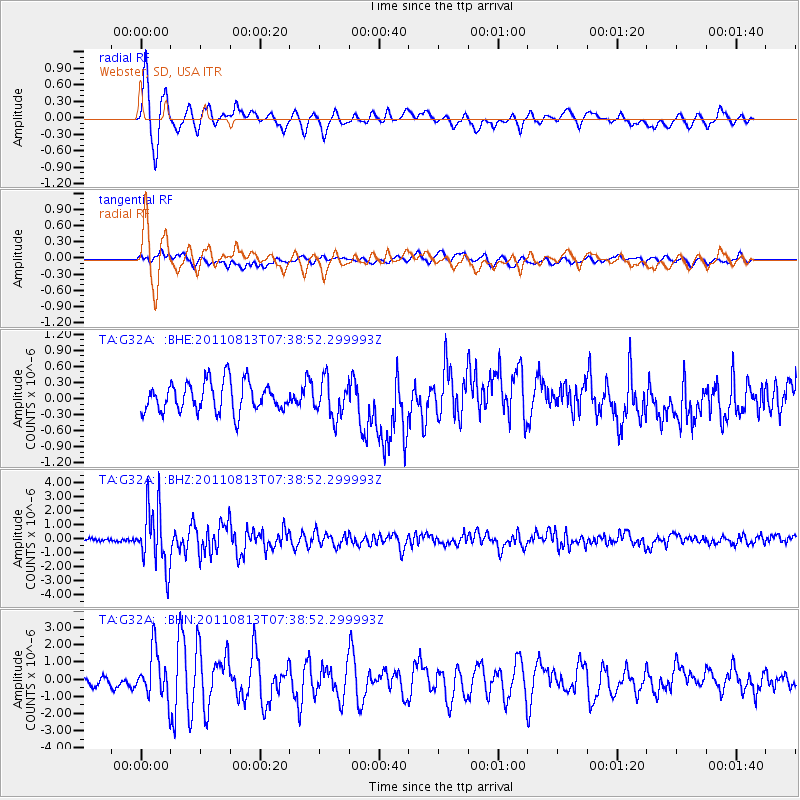
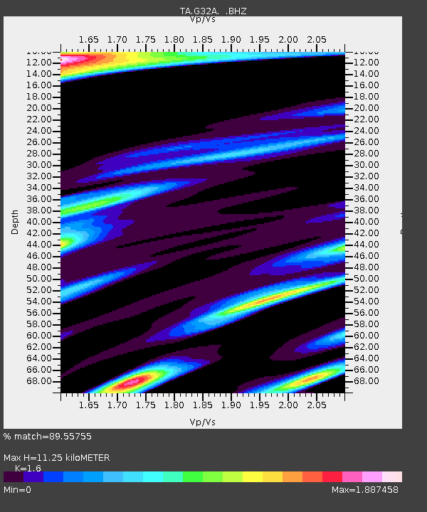
Earthquake location: Off Coast Of Chiapas, Mexico
Earthquake latitude/longitude: 14.4/-94.7
Earthquake time(UTC): 2011/08/13 (225) 07:33:06 GMT
Earthquake Depth: 6.0 km
Earthquake Magnitude: 5.7 MB, 5.2 MS, 5.8 MW, 5.6 MW
Earthquake Catalog/Contributor: WHDF/NEIC
Network: TA USArray Transportable Network (new EarthScope stations)
Station: G32A Webster, SD, USA
Lat/Lon: 45.26 N/97.50 W
Elevation: 566 m
Distance: 30.9 deg
Az: 356.107 deg
Baz: 174.656 deg
Ray Param: 0.07922754
Estimated Moho Depth: 11.25 km
Estimated Crust Vp/Vs: 1.60
Assumed Crust Vp: 6.552 km/s
Estimated Crust Vs: 4.095 km/s
Estimated Crust Poisson's Ratio: 0.18
Radial Match: 89.55755 %
Radial Bump: 400
Transverse Match: 48.438595 %
Transverse Bump: 400
SOD ConfigId: 410809
Insert Time: 2012-01-06 04:56:03.700 +0000
GWidth: 2.5
Max Bumps: 400
Tol: 0.001

Signal To Noise

ChannelStoNSTALTA
TA:G32A: :BHZ:20110813T07:38:52.299993Z20.3128362.1351293E-61.0511233E-7
TA:G32A: :BHN:20110813T07:38:52.299993Z4.1341481.3774913E-63.3319836E-7
TA:G32A: :BHE:20110813T07:38:52.299993Z1.24289753.4390382E-72.7669523E-7
Arrivals
Ps1.1 SECOND
PpPs4.1 SECOND
PsPs/PpSs5.2 SECOND