
F31A Hecla, SD, USA - Earthquake Result Viewer
| ||||||||||||||||||
| ||||||||||||||||||
| ||||||||||||||||||
|
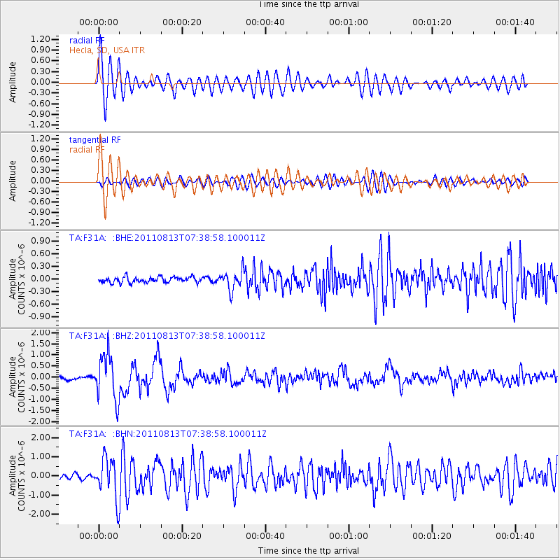
Signal To Noise
| Channel | StoN | STA | LTA |
| TA:F31A: :BHZ:20110813T07:38:58.100011Z | 15.629031 | 1.0367501E-6 | 6.6334884E-8 |
| TA:F31A: :BHN:20110813T07:38:58.100011Z | 8.698488 | 1.0837452E-6 | 1.2459007E-7 |
| TA:F31A: :BHE:20110813T07:38:58.100011Z | 3.5835404 | 2.3475309E-7 | 6.55087E-8 |
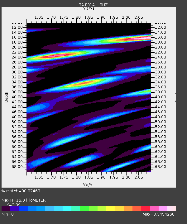
| Arrivals | |
| Ps | 2.9 SECOND |
| PpPs | 7.1 SECOND |
| PsPs/PpSs | 9.9 SECOND |

