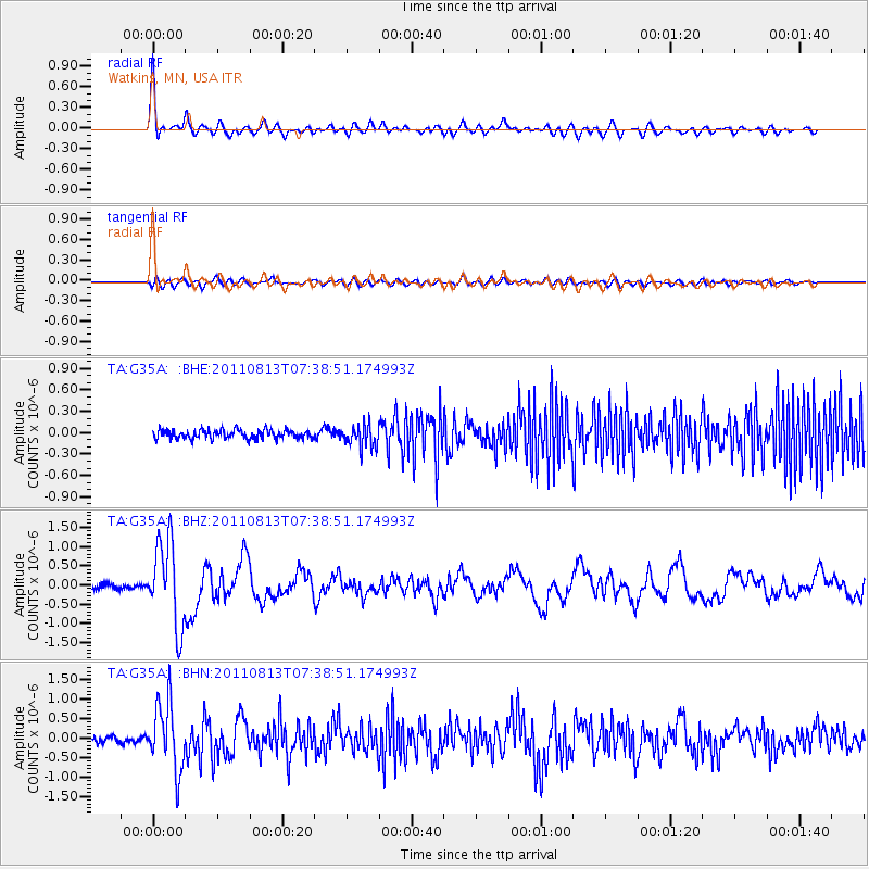
G35A Watkins, MN, USA - Earthquake Result Viewer
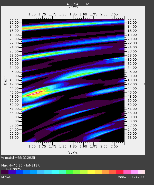
Earthquake location: Off Coast Of Chiapas, Mexico
Earthquake latitude/longitude: 14.4/-94.7
Earthquake time(UTC): 2011/08/13 (225) 07:33:06 GMT
Earthquake Depth: 6.0 km
Earthquake Magnitude: 5.7 MB, 5.2 MS, 5.8 MW, 5.6 MW
Earthquake Catalog/Contributor: WHDF/NEIC
Network: TA USArray Transportable Network (new EarthScope stations)
Station: G35A Watkins, MN, USA
Lat/Lon: 45.22 N/94.49 W
Elevation: 361 m
Distance: 30.7 deg
Az: 0.261 deg
Baz: 180.358 deg
Ray Param: 0.079261236
Estimated Moho Depth: 46.25 km
Estimated Crust Vp/Vs: 1.66
Assumed Crust Vp: 6.571 km/s
Estimated Crust Vs: 3.952 km/s
Estimated Crust Poisson's Ratio: 0.22
Radial Match: 88.312935 %
Radial Bump: 400
Transverse Match: 63.79603 %
Transverse Bump: 400
SOD ConfigId: 410809
Insert Time: 2012-01-06 04:56:45.641 +0000
GWidth: 2.5
Max Bumps: 400
Tol: 0.001

Signal To Noise

ChannelStoNSTALTA
TA:G35A: :BHZ:20110813T07:38:51.174993Z16.2483061.0999847E-66.769842E-8
TA:G35A: :BHN:20110813T07:38:51.174993Z10.7021358.4845624E-77.9279154E-8
TA:G35A: :BHE:20110813T07:38:51.174993Z2.53861261.5534323E-76.1192175E-8
Arrivals
Ps5.1 SECOND
PpPs17 SECOND
PsPs/PpSs22 SECOND