
A33A Warroad, MN, USA - Earthquake Result Viewer
| ||||||||||||||||||
| ||||||||||||||||||
| ||||||||||||||||||
|
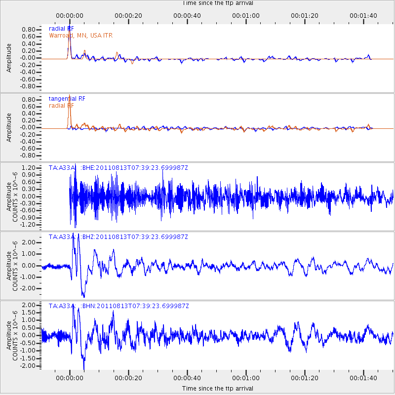
Signal To Noise
| Channel | StoN | STA | LTA |
| TA:A33A: :BHZ:20110813T07:39:23.699987Z | 11.447714 | 1.5587E-6 | 1.3615819E-7 |
| TA:A33A: :BHN:20110813T07:39:23.699987Z | 3.062862 | 1.0429053E-6 | 3.4050026E-7 |
| TA:A33A: :BHE:20110813T07:39:23.699987Z | 0.99927825 | 4.2262923E-7 | 4.2293448E-7 |
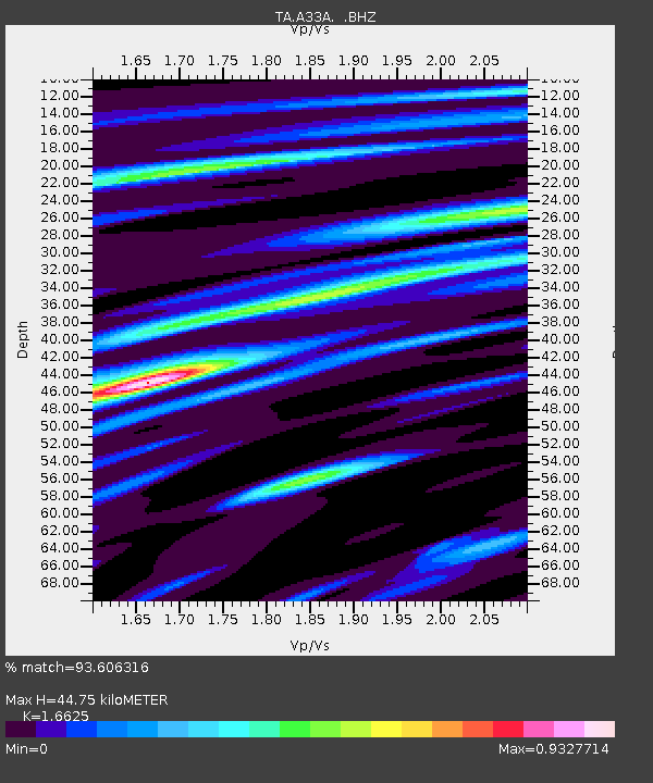
| Arrivals | |
| Ps | 5.0 SECOND |
| PpPs | 17 SECOND |
| PsPs/PpSs | 22 SECOND |

