LTY Liberty (broad-band) - Earthquake Result Viewer
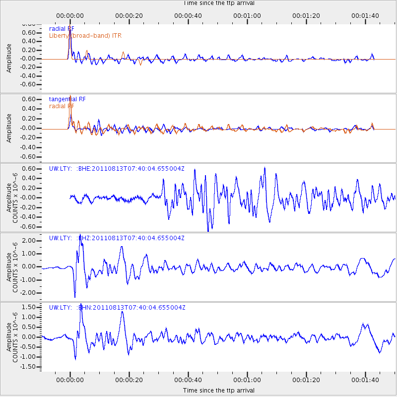
Earthquake location: Off Coast Of Chiapas, Mexico
Earthquake latitude/longitude: 14.4/-94.7
Earthquake time(UTC): 2011/08/13 (225) 07:33:06 GMT
Earthquake Depth: 6.0 km
Earthquake Magnitude: 5.7 MB, 5.2 MS, 5.8 MW, 5.6 MW
Earthquake Catalog/Contributor: WHDF/NEIC
Network: UW Pacific Northwest Regional Seismic Network
Station: LTY Liberty (broad-band)
Lat/Lon: 47.26 N/120.66 W
Elevation: 970 m
Distance: 39.3 deg
Az: 331.862 deg
Baz: 137.866 deg
Ray Param: 0.07509104
Estimated Moho Depth: 14.5 km
Estimated Crust Vp/Vs: 2.10
Assumed Crust Vp: 6.597 km/s
Estimated Crust Vs: 3.145 km/s
Estimated Crust Poisson's Ratio: 0.35
Radial Match: 91.97709 %
Radial Bump: 400
Transverse Match: 84.657585 %
Transverse Bump: 400
SOD ConfigId: 410809
Insert Time: 2012-01-06 05:00:02.339 +0000
GWidth: 2.5
Max Bumps: 400
Tol: 0.001

Signal To Noise

ChannelStoNSTALTA
UW:LTY: :BHZ:20110813T07:40:04.655004Z21.6953961.2303041E-65.6708075E-8
UW:LTY: :BHN:20110813T07:40:04.655004Z10.7964016.8287335E-76.325009E-8
UW:LTY: :BHE:20110813T07:40:04.655004Z4.6054011.9754913E-74.28951E-8
Arrivals
Ps2.6 SECOND
PpPs6.4 SECOND
PsPs/PpSs9.0 SECOND