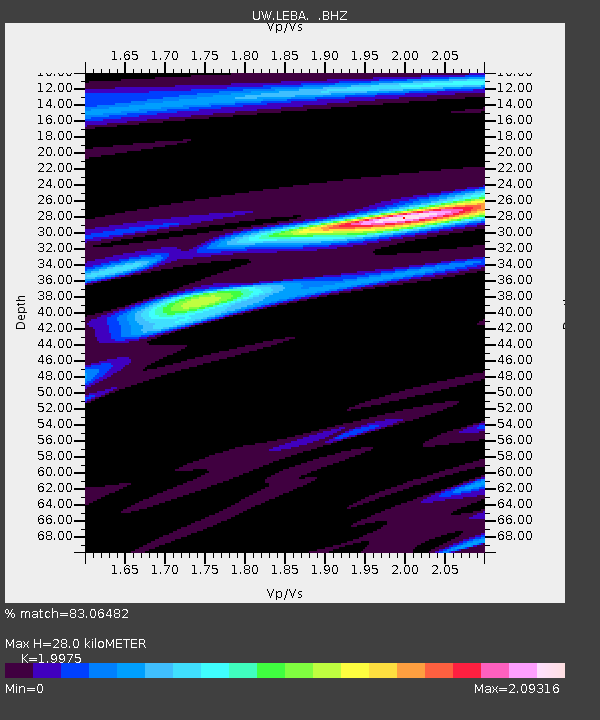
LEBA Lebam, WA, USA - Earthquake Result Viewer
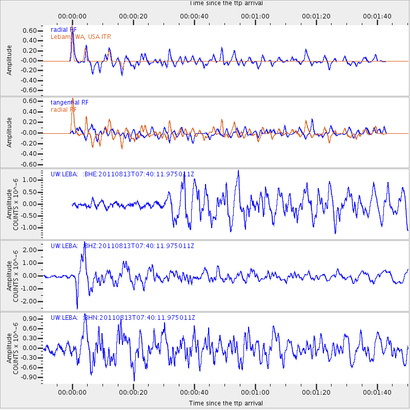
Earthquake location: Off Coast Of Chiapas, Mexico
Earthquake latitude/longitude: 14.4/-94.7
Earthquake time(UTC): 2011/08/13 (225) 07:33:06 GMT
Earthquake Depth: 6.0 km
Earthquake Magnitude: 5.7 MB, 5.2 MS, 5.8 MW, 5.6 MW
Earthquake Catalog/Contributor: WHDF/NEIC
Network: UW Pacific Northwest Regional Seismic Network
Station: LEBA Lebam, WA, USA
Lat/Lon: 46.55 N/123.56 W
Elevation: 73 m
Distance: 40.2 deg
Az: 328.861 deg
Baz: 133.447 deg
Ray Param: 0.07456659
Estimated Moho Depth: 28.0 km
Estimated Crust Vp/Vs: 2.00
Assumed Crust Vp: 6.566 km/s
Estimated Crust Vs: 3.287 km/s
Estimated Crust Poisson's Ratio: 0.33
Radial Match: 83.06482 %
Radial Bump: 400
Transverse Match: 70.263145 %
Transverse Bump: 400
SOD ConfigId: 410809
Insert Time: 2012-01-06 05:01:27.657 +0000
GWidth: 2.5
Max Bumps: 400
Tol: 0.001

Signal To Noise

ChannelStoNSTALTA
UW:LEBA: :BHZ:20110813T07:40:11.975011Z13.64207651.1831266E-68.672629E-8
UW:LEBA: :BHN:20110813T07:40:11.975011Z5.2066224.5867702E-78.8094936E-8
UW:LEBA: :BHE:20110813T07:40:11.975011Z4.7690294.418106E-79.264162E-8
Arrivals
Ps4.5 SECOND
PpPs12 SECOND
PsPs/PpSs17 SECOND