DRV Dumont d'Urville, Terre Adelie (Antartica) - Earthquake Result Viewer
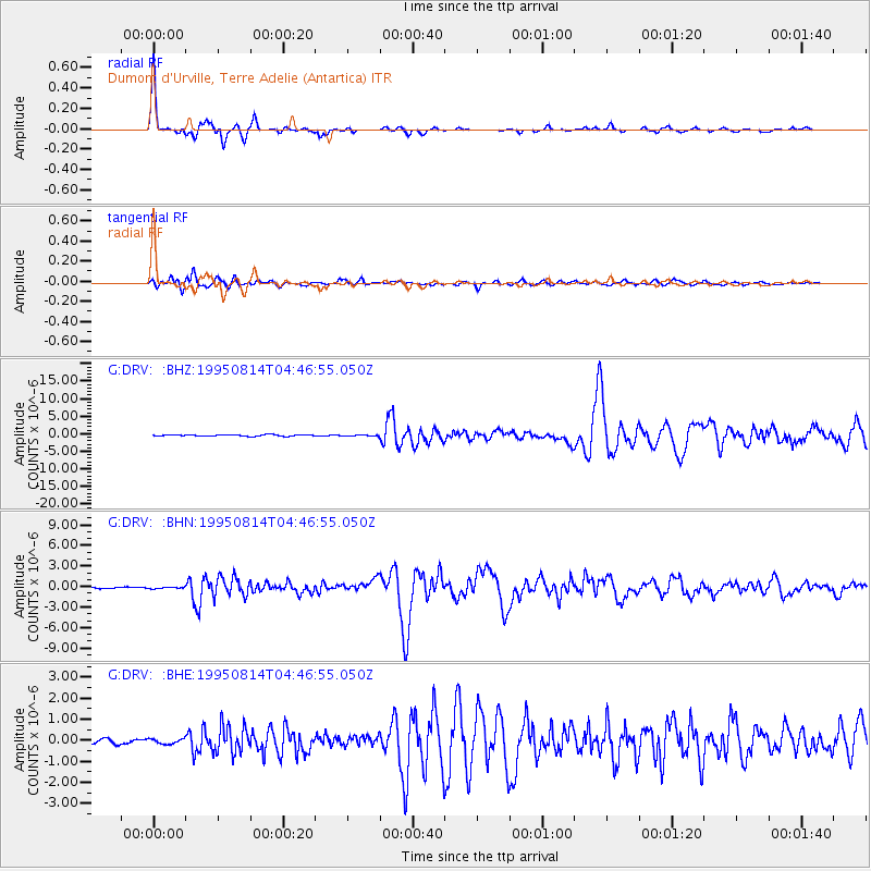
Earthquake location: New Britain Region, P.N.G.
Earthquake latitude/longitude: -4.8/151.5
Earthquake time(UTC): 1995/08/14 (226) 04:37:17 GMT
Earthquake Depth: 126 km
Earthquake Magnitude: 6.3 MB, 6.3 MS, 6.4 UNKNOWN
Earthquake Catalog/Contributor: WHDF/NEIC
Network: G GEOSCOPE
Station: DRV Dumont d'Urville, Terre Adelie (Antartica)
Lat/Lon: 66.67 S/140.01 E
Elevation: 40 m
Distance: 62.2 deg
Az: 185.147 deg
Baz: 12.97 deg
Ray Param: 0.05998851
Estimated Moho Depth: 22.5 km
Estimated Crust Vp/Vs: 1.61
Assumed Crust Vp: 6.39 km/s
Estimated Crust Vs: 3.969 km/s
Estimated Crust Poisson's Ratio: 0.19
Radial Match: 98.17516 %
Radial Bump: 307
Transverse Match: 93.01129 %
Transverse Bump: 400
SOD ConfigId: 6273
Insert Time: 2010-02-26 22:02:01.908 +0000
GWidth: 2.5
Max Bumps: 400
Tol: 0.001

Signal To Noise

ChannelStoNSTALTA
G:DRV: :BHN:19950814T04:46:55.050Z1.02625481.1530061E-71.12350854E-7
G:DRV: :BHE:19950814T04:46:55.050Z0.99577311.351524E-71.3572611E-7
G:DRV: :BHZ:19950814T04:46:55.050Z0.526355451.02301584E-71.9435838E-7
Arrivals
Ps2.3 SECOND
PpPs8.8 SECOND
PsPs/PpSs11 SECOND