You are here: Home > Network List > CI - Caltech Regional Seismic Network Stations List
> Station SMM Simmler, CA, USA > Earthquake Result Viewer
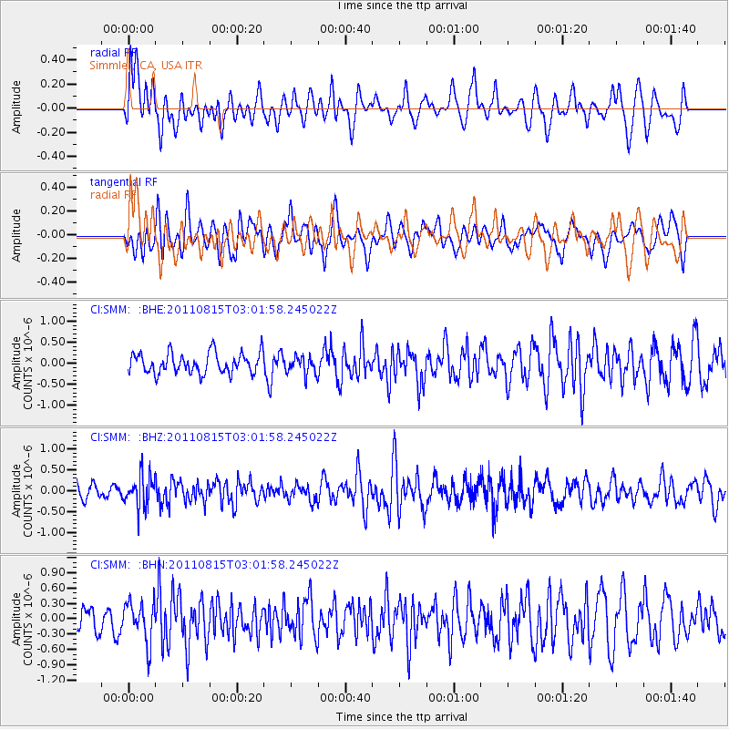
SMM Simmler, CA, USA - Earthquake Result Viewer
*The percent match for this event was below the threshold and hence no stack was calculated.
| Earthquake location: |
Ecuador |
| Earthquake latitude/longitude: |
-1.8/-76.9 |
| Earthquake time(UTC): |
2011/08/15 (227) 02:53:18 GMT |
| Earthquake Depth: |
177 km |
| Earthquake Magnitude: |
5.7 MB, 5.7 MW, 5.7 MW |
| Earthquake Catalog/Contributor: |
WHDF/NEIC |
|
| Network: |
CI Caltech Regional Seismic Network |
| Station: |
SMM Simmler, CA, USA |
| Lat/Lon: |
35.31 N/120.00 W |
| Elevation: |
599 m |
|
| Distance: |
54.6 deg |
| Az: |
316.754 deg |
| Baz: |
123.14 deg |
| Ray Param: |
$rayparam |
*The percent match for this event was below the threshold and hence was not used in the summary stack. |
|
| Radial Match: |
54.78772 % |
| Radial Bump: |
400 |
| Transverse Match: |
53.95348 % |
| Transverse Bump: |
400 |
| SOD ConfigId: |
410809 |
| Insert Time: |
2012-01-06 05:11:47.332 +0000 |
| GWidth: |
2.5 |
| Max Bumps: |
400 |
| Tol: |
0.001 |
|
Signal To Noise
| Channel | StoN | STA | LTA |
| CI:SMM: :BHZ:20110815T03:01:58.245022Z | 2.0491705 | 3.8136957E-7 | 1.8610926E-7 |
| CI:SMM: :BHN:20110815T03:01:58.245022Z | 1.673676 | 3.9772632E-7 | 2.3763639E-7 |
| CI:SMM: :BHE:20110815T03:01:58.245022Z | 0.8768815 | 2.1200985E-7 | 2.417771E-7 |
| Arrivals |
| Ps | |
| PpPs | |
| PsPs/PpSs | |


