
DRV Dumont d'Urville, Terre Adelie (Antartica) - Earthquake Result Viewer
| ||||||||||||||||||
| ||||||||||||||||||
| ||||||||||||||||||
|
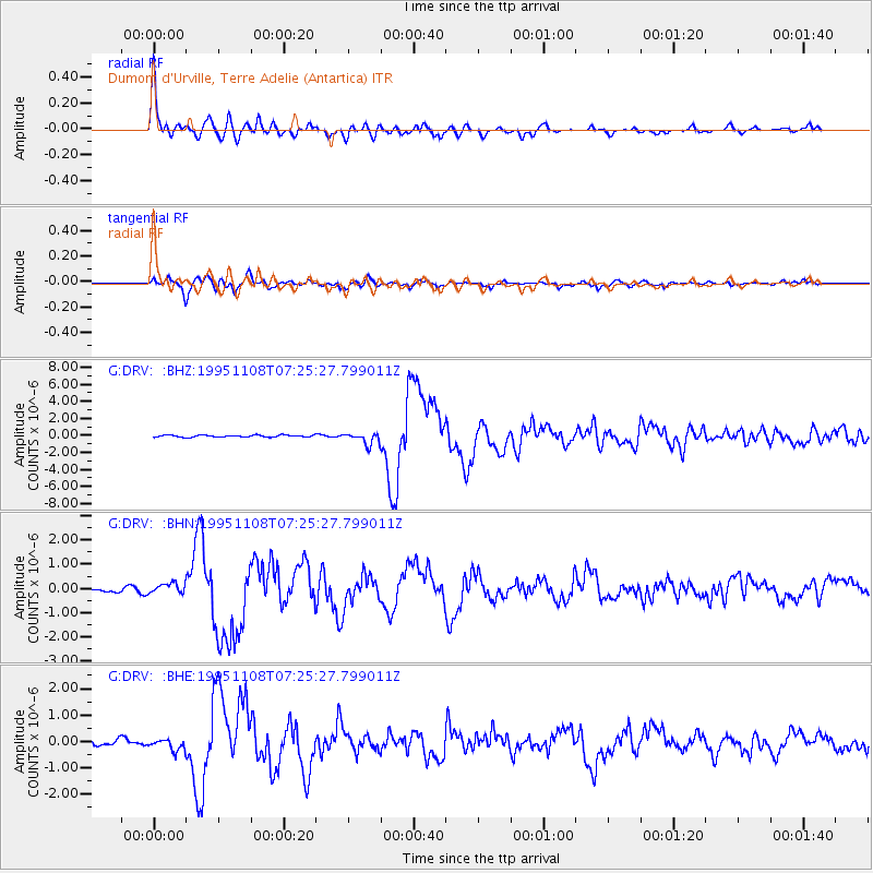
Signal To Noise
| Channel | StoN | STA | LTA |
| G:DRV: :BHN:19951108T07:25:27.799011Z | 3.1922488 | 2.2669177E-7 | 7.101319E-8 |
| G:DRV: :BHE:19951108T07:25:27.799011Z | 1.755531 | 2.2825613E-7 | 1.3002114E-7 |
| G:DRV: :BHZ:19951108T07:25:27.799011Z | 6.0506883 | 7.0176554E-7 | 1.1598111E-7 |
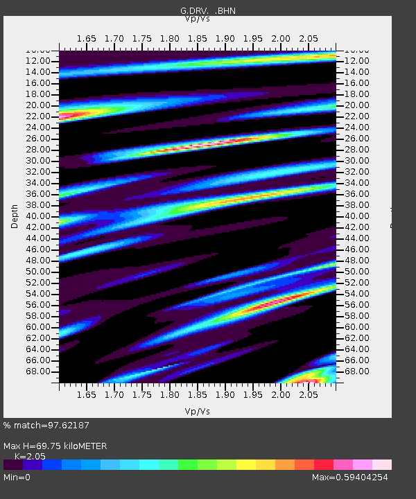
| Arrivals | |
| Ps | 12 SECOND |
| PpPs | 32 SECOND |
| PsPs/PpSs | 44 SECOND |

