
DRV Dumont d'Urville, Terre Adelie (Antartica) - Earthquake Result Viewer
| ||||||||||||||||||
| ||||||||||||||||||
| ||||||||||||||||||
|
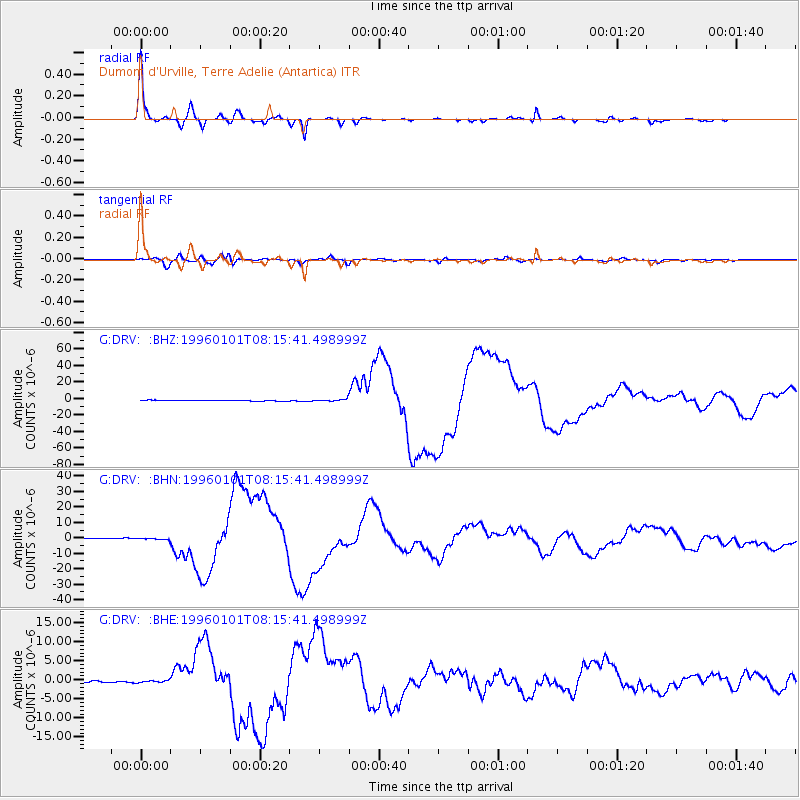
Signal To Noise
| Channel | StoN | STA | LTA |
| G:DRV: :BHN:19960101T08:15:41.498999Z | 2.1411412 | 4.7246309E-7 | 2.2065949E-7 |
| G:DRV: :BHE:19960101T08:15:41.498999Z | 1.372399 | 2.7823356E-7 | 2.0273518E-7 |
| G:DRV: :BHZ:19960101T08:15:41.498999Z | 2.7883174 | 1.2881895E-6 | 4.619953E-7 |
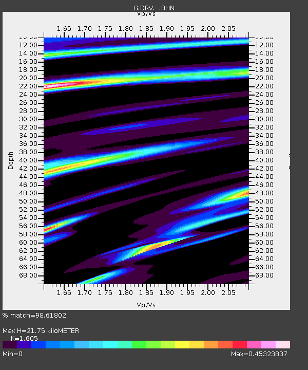
| Arrivals | |
| Ps | 2.1 SECOND |
| PpPs | 8.5 SECOND |
| PsPs/PpSs | 11 SECOND |

