You are here: Home > Network List > TA - USArray Transportable Network (new EarthScope stations) Stations List
> Station X36A Centrahoma, OK, USA > Earthquake Result Viewer
X36A Centrahoma, OK, USA - Earthquake Result Viewer
*The percent match for this event was below the threshold and hence no stack was calculated.
| Earthquake location: |
Ecuador |
| Earthquake latitude/longitude: |
-1.8/-76.9 |
| Earthquake time(UTC): |
2011/08/15 (227) 02:53:18 GMT |
| Earthquake Depth: |
177 km |
| Earthquake Magnitude: |
5.7 MB, 5.7 MW, 5.7 MW |
| Earthquake Catalog/Contributor: |
WHDF/NEIC |
|
| Network: |
TA USArray Transportable Network (new EarthScope stations) |
| Station: |
X36A Centrahoma, OK, USA |
| Lat/Lon: |
34.57 N/96.35 W |
| Elevation: |
211 m |
|
| Distance: |
40.5 deg |
| Az: |
334.997 deg |
| Baz: |
149.207 deg |
| Ray Param: |
$rayparam |
*The percent match for this event was below the threshold and hence was not used in the summary stack. |
|
| Radial Match: |
66.56028 % |
| Radial Bump: |
400 |
| Transverse Match: |
60.819874 % |
| Transverse Bump: |
400 |
| SOD ConfigId: |
410809 |
| Insert Time: |
2012-01-06 05:31:46.165 +0000 |
| GWidth: |
2.5 |
| Max Bumps: |
400 |
| Tol: |
0.001 |
|
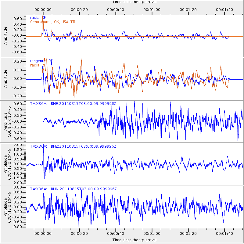
Signal To Noise
| Channel | StoN | STA | LTA |
| TA:X36A: :BHZ:20110815T03:00:09.999996Z | 7.187645 | 6.9466773E-7 | 9.6647476E-8 |
| TA:X36A: :BHN:20110815T03:00:09.999996Z | 2.9137034 | 2.7122846E-7 | 9.308718E-8 |
| TA:X36A: :BHE:20110815T03:00:09.999996Z | 2.4003804 | 1.5662619E-7 | 6.525057E-8 |
| Arrivals |
| Ps | |
| PpPs | |
| PsPs/PpSs | |


