You are here: Home > Network List > TA - USArray Transportable Network (new EarthScope stations) Stations List
> Station Y42A Garnett, Star City, AR, USA > Earthquake Result Viewer
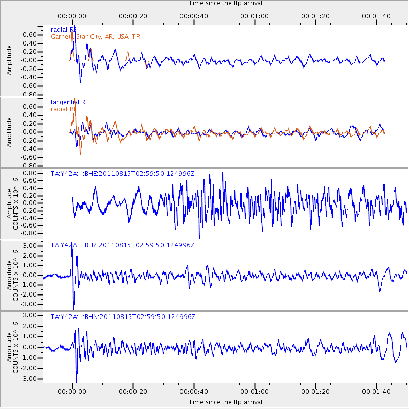
Y42A Garnett, Star City, AR, USA - Earthquake Result Viewer
*The percent match for this event was below the threshold and hence no stack was calculated.
| Earthquake location: |
Ecuador |
| Earthquake latitude/longitude: |
-1.8/-76.9 |
| Earthquake time(UTC): |
2011/08/15 (227) 02:53:18 GMT |
| Earthquake Depth: |
177 km |
| Earthquake Magnitude: |
5.7 MB, 5.7 MW, 5.7 MW |
| Earthquake Catalog/Contributor: |
WHDF/NEIC |
|
| Network: |
TA USArray Transportable Network (new EarthScope stations) |
| Station: |
Y42A Garnett, Star City, AR, USA |
| Lat/Lon: |
33.84 N/91.79 W |
| Elevation: |
77 m |
|
| Distance: |
38.1 deg |
| Az: |
339.747 deg |
| Baz: |
155.438 deg |
| Ray Param: |
$rayparam |
*The percent match for this event was below the threshold and hence was not used in the summary stack. |
|
| Radial Match: |
75.374535 % |
| Radial Bump: |
400 |
| Transverse Match: |
68.00534 % |
| Transverse Bump: |
400 |
| SOD ConfigId: |
410809 |
| Insert Time: |
2012-01-06 05:52:31.788 +0000 |
| GWidth: |
2.5 |
| Max Bumps: |
400 |
| Tol: |
0.001 |
|
Signal To Noise
| Channel | StoN | STA | LTA |
| TA:Y42A: :BHZ:20110815T02:59:50.124996Z | 12.840605 | 1.4085274E-6 | 1.09693225E-7 |
| TA:Y42A: :BHN:20110815T02:59:50.124996Z | 8.423647 | 1.1164633E-6 | 1.3253918E-7 |
| TA:Y42A: :BHE:20110815T02:59:50.124996Z | 1.4442552 | 2.6879403E-7 | 1.8611254E-7 |
| Arrivals |
| Ps | |
| PpPs | |
| PsPs/PpSs | |


