You are here: Home > Network List > TA - USArray Transportable Network (new EarthScope stations) Stations List
> Station Z44A Pea Ridge, Belzoni, MS, USA > Earthquake Result Viewer
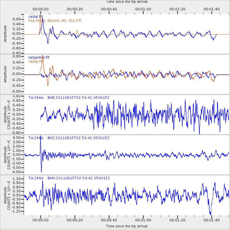
Z44A Pea Ridge, Belzoni, MS, USA - Earthquake Result Viewer
*The percent match for this event was below the threshold and hence no stack was calculated.
| Earthquake location: |
Ecuador |
| Earthquake latitude/longitude: |
-1.8/-76.9 |
| Earthquake time(UTC): |
2011/08/15 (227) 02:53:18 GMT |
| Earthquake Depth: |
177 km |
| Earthquake Magnitude: |
5.7 MB, 5.7 MW, 5.7 MW |
| Earthquake Catalog/Contributor: |
WHDF/NEIC |
|
| Network: |
TA USArray Transportable Network (new EarthScope stations) |
| Station: |
Z44A Pea Ridge, Belzoni, MS, USA |
| Lat/Lon: |
33.28 N/90.43 W |
| Elevation: |
39 m |
|
| Distance: |
37.2 deg |
| Az: |
341.078 deg |
| Baz: |
157.237 deg |
| Ray Param: |
$rayparam |
*The percent match for this event was below the threshold and hence was not used in the summary stack. |
|
| Radial Match: |
78.34481 % |
| Radial Bump: |
400 |
| Transverse Match: |
54.808826 % |
| Transverse Bump: |
400 |
| SOD ConfigId: |
410809 |
| Insert Time: |
2012-01-06 05:53:59.421 +0000 |
| GWidth: |
2.5 |
| Max Bumps: |
400 |
| Tol: |
0.001 |
|
Signal To Noise
| Channel | StoN | STA | LTA |
| TA:Z44A: :BHZ:20110815T02:59:42.050015Z | 12.786817 | 1.4625112E-6 | 1.1437649E-7 |
| TA:Z44A: :BHN:20110815T02:59:42.050015Z | 2.4728594 | 3.8523402E-7 | 1.5578486E-7 |
| TA:Z44A: :BHE:20110815T02:59:42.050015Z | 1.9644341 | 2.8709073E-7 | 1.4614425E-7 |
| Arrivals |
| Ps | |
| PpPs | |
| PsPs/PpSs | |


